What is recorded here
The Bawn or enclosure that surrounds Grange Castle is formed on a distinct rock outcrop on which Grange Castle (LI032-001002-) once stood. The castle enclosure is located 40m E of the townland boundary with Grange and 840m W of Lough Gur. The rock outcrop and castle site are depicted on the 1840 ed. OSi 6-inch map and are also depicted on the 1897 ed. OSi 25-inch map where the rock outcrop is illustrated as a roughly sub-rectangular rock formation (ext. dims. c. 100m N-S; 22m E-W). The rock is identified on the OSi Cassini 6-inch map as 'Cathair Chinn Chon', which was one of the seats of the King of Cashel (O'Kelly 1944, 51). According to Lynch (1895, 251) this rock was called 'Grange Rock' and that the stones from Grange Castle were used in the construction of Raheen House located 460m to the SW (ibid.). There are conflicting claims as to the location of Cathair Chinn Chon, O'Donovan identified it as a stone fort or cashel standing near Rockbarton, the residence of Lord Guillamore (Lynch 1917, 231). In spite of this, the rock outcrop is likely to have been a focus for settlement prior to the construction of the castle and was almost certainly a focus for outbuildings around the castle tower whilst it was in use. The site is covered is scrub woodland and is visible as heavily overgrown rock outcrop on Google Earth orthoimages taken 16/03/2016; 28/06/2018 and 20/09/2020. See attached Google Earth orthoimages
Compiled by: Edmond O’Donovan
Date of upload: 3 November 2020
The Bawn or enclosure that surrounds Grange Castle is formed on a distinct rock outcrop on which Grange Castle (LI032-001002-) once stood. The castle enclosure is located 40m E of the townland boundary with Grange and 840m W of Lough Gur. The rock outcrop and castle site are depicted on the 1840 ed. OSi 6-inch map and are also depicted on the 1897 ed. OSi 25-inch map where the rock outcrop is illustrated as a…
From the National Monuments Service (Archaeological Survey of Ireland) record LI032-001001
The monument record does not grant public access. Check the route and ask the landowner before entering private land.
- What survives
- Recorded monument
Places near here
Photo credits
- No machine-readable author provided. Christian1965~commonswiki assumed (based on copyright claims)., Wikimedia Commons · Public domain
- Martin Richard Phelan, Wikimedia Commons · CC BY-SA 2.0
- David Hawgood, Wikimedia Commons · CC BY-SA 2.0
- Oliver Dixon, Wikimedia Commons · CC BY-SA 2.0
- National Inventory of Architectural Heritage
- Algirdas at Lithuanian Wikipedia, Wikimedia Commons · Public domain
- Oliver Dixon, Geograph · CC BY-SA 2.0
- Martin Richard Phelan, Geograph · CC BY-SA 2.0
 Lough GurVisitor information · 440 yd
 Grange Stone circleVisitor information · 442 yd
 Stone CirclesStone circle · 502 yd
 Stone CirclesStone circle, embanked · 505 yd
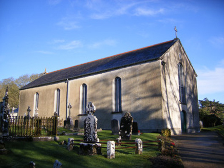 Catholic Church of Saint Patrick and Saint BrigidChurch/chapel · 750 yd
 post box853 ydGarret IslandCastle, unclassified · 1210 ydBlack Castle (in ruins)Castle, tower house · 1.1 mi
 Pedunculate Oak1.2 mi
 The SpectaclesVisitor information · 1.3 mi
 Lough Gur Heritage CentreVisitor information · 1.3 miGlen BogForest · 2.4 mi
More castles and forts in County Limerick · All of County Limerick
What do you know about this place?