What is recorded here
Situated on top of a natural rise, in gently undulating pasture with good views in all directions. Depicted on the OS 6-inch map as an oval-shaped earthwork (dims. 35m N-S; 29m E-W), depicted as a polygonal-shaped field and not as an antiquity on the 1838 ed. OS 6-inch map. Levelled earthwork described in 1971 as no surface remains visible on a natural rise of land. Outline of tree-lined hillock visible on Digital Globe aerial photograph.
Situated on top of a natural rise, in gently undulating pasture with good views in all directions. Depicted on the OS 6-inch map as an oval-shaped earthwork (dims. 35m N-S; 29m E-W), depicted as a polygonal-shaped field and not as an antiquity on the 1838 ed. OS 6-inch map. Levelled earthwork described in 1971 as no surface remains visible on a natural rise of land. Outline of tree-lined hillock visible on…
From the National Monuments Service (Archaeological Survey of Ireland) record WM023-073
The monument record does not grant public access. Check the route and ask the landowner before entering private land.
- What survives
- Recorded monument
Places near here
Photo credits
- National Inventory of Architectural Heritage
- Kieran Campbell, Wikimedia Commons · CC BY-SA 2.0
- Wikimedia Commons contributor · CC BY-SA 3.0
- Willow, Wikimedia Commons · CC BY 2.5
- Pat Byrne, Geograph · Creative Commons Attribution-ShareAlike 2.0
- Christophe Krief, Wikimedia Commons · CC BY-SA 4.0
- Sgbrito at Portuguese Wikipedia, Wikimedia Commons · Public domain
- Mike Searle, Geograph · CC BY-SA 2.0
- Peter Gerken, Wikimedia Commons · CC BY-SA 2.0
- Engraving by Johannes Tangena. Leyden: Johannes Tangena, Print en Bockverkooper 1691., Wikimedia Commons · Public domain
- Arno-nl, Wikimedia Commons · CC BY-SA 4.0
 KilleennadrawHouse · 1509 yd
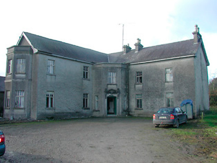 Lissanode HouseHouse · 1.1 mi
 CastleCastle, motte and bailey · 3.4 mi
 Moydrum CastleCastle · 4.4 mi
 European ash7.4 mi
 WeirWeir, fish · 7.6 mi
 Athlone CastleVisitor information · 7.7 mi
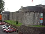 Athlone CastleMuseum · 7.7 mi
 Historic Town - Athlone Castle & Church of St Peter and PaulVisitor information · 7.7 mi
 Siege of AthloneSiege · 7.8 mi
 Siege of AthloneSiege · 7.8 mi
 Safe HarbourBay · 11 mi
More archaeology and monuments in County Westmeath · All of County Westmeath
What do you know about this place?