
Places near here
Photo credits
- Tdr112, Wikimedia Commons · CC BY-SA 4.0
- National Inventory of Architectural Heritage
- Jo and Steve Turner, Geograph · CC BY-SA 2.0
- Paul Johnston-Knight, Wikimedia Commons · CC BY-SA 2.0
- Ian Paterson, Geograph · CC BY-SA 2.0
- Amir Mohammad Saeid, Wikimedia Commons · CC BY-SA 4.0
- jwd, Geograph · CC BY-SA 2.0
- Ian Paterson, Wikimedia Commons · CC BY-SA 2.0
- JP, Geograph · CC BY-SA 2.0
- Sitomon, Wikimedia Commons · CC BY-SA 2.0
 St John's C of I ChurchChurch/chapel · 6 yd
Explorer Tom St John's Church in Clondalkin was built in 1789 on the site of an old monastery. Medieval remains are still in the graveyard. It’s a simple, charming focal point on Tower Road. Look out for the tower!
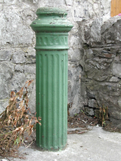 water pump40 yd
Explorer Tom The Clondalkin water pump is retired but still posing for photos like it’s got a job to do. It probably whispers bitter things about the modern tap that replaced it. Squeeze its handle, see if it squeaks in anger.
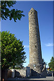 Round Tower43 yd
Explorer Tom Round Tower in Clondalkin has been standing since the 7th century, watching Dublin grow from mud huts to skyscrapers without losing its cool. It’s seen emperors and engineers, but it’s still just a tall, lonely cylinder in a field. Dare you to say hello to it out loud.
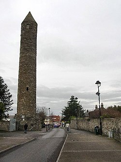 Clondalkin Round TowerHeritage attraction · 43 yd
Explorer Tom Clondalkin Round Tower in County Dublin is 84 feet high and has a conical cap like a wizard's hat. It's from the 8th century, so it's seen some things. Take a picture of the top!
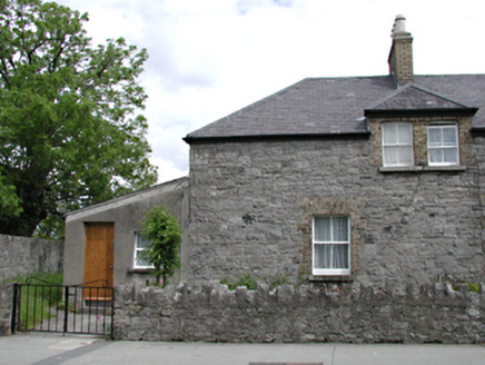 almshouse44 yd
Explorer Tom Almshouse in Clondalkin was built in 1879 in memory of Reverend David John Reade, blending in nicely with St. John’s Church nearby. It's now a private house but keeps that original style of fenestration perfectly.
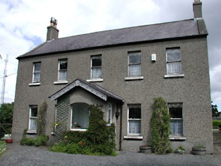 TowervilleHouse · 47 yd
Explorer Tom Towerville in Clondalkin is big enough to hide an entire secret society, or just a really lazy cat. Mr. William Caldbeck built it for status, but now it just echoes with the sound of its own importance. Bring a friend who isn't afraid of quiet.
 The Round TowerVisitor information · 77 yd
Explorer Tom The Round Tower in Clondalkin is 84 feet high and has original stairs. It's been a refuge since the 10th century. Grab a photo of the top for me!
 CastleCastle, unclassified · 382 yd
Explorer Tom Castle in Clondalkin is Tully’s Castle, a narrow 16th-century tower with crenellations right on Monastery Road. It’s in state care, so it’s basically a celebrity that can’t leave the house. Ring your granny and tell her where you are before she worries about the round tower.
 Griffeen Valley WalkWalking route · 2.3 mi
Explorer Tom Griffeen Valley Walk in County Dublin has a river that merges into Vesey Park, which sounds like a fancy garden party gone wrong. Grab a photo of the water for me!
 Rathcoole ParkPark · 3.9 mi
Explorer Tom Rathcoole Park in County Dublin has trees that remember every secret whispered beneath them. The wind carries old gossip today. Lean against a trunk and listen for the juicy details from centuries past.
 Grand Canal WayWalking route · 4.3 mi
Explorer Tom Grand Canal Way in County Dublin is pretending to be Kildare according to one cheeky map note. A little county peninsula poking through like a nosy neighbour. Tell me if it's still hiding!
 European Yew4.8 mi
Explorer Tom European Yew in County Dublin has an imaginary fan club called 'The Conifer Lovers' who meet underground. They probably argue about which branch is the most majestic and throw leaves at each other. Bring a flask of something warm and a story to swap with them.
More archaeology and monuments in County Dublin · All of County Dublin

What do you know about this place?Tap to add a comment or ask a question