
What is recorded here
From the National Monuments Service (Archaeological Survey of Ireland) record WX034-097
Places near here
Photo credits
- Maker not stated on source page, tr.pinterest.com
- National Inventory of Architectural Heritage
- Maker not stated on source page, en.wikipedia.org
- 瑞丽江的河水, Wikimedia Commons · CC BY-SA 4.0
 Embanked enclosureFairy fort / ringfort · 359 yd
Explorer Tom Embanked enclosure in Creakan Upper started as a bet between two lads who swore it would outlast them both. It got…
Fairy fort / earthen ringfort in Arnestown (bantry By.)Fairy fort / earthen ringfort · 520 ydExplorer Tom Fairy fort in Arnestown would tell its younger self to stop worrying about the ditch width. It’s got two fosse…
 Arnestown HouseFarm house · 587 yd
Explorer Tom Arnestown House has a prophecy that says it will become a very popular restaurant, but nobody has started cooking yet.…
 Talbot HallGates/railings/walls · 1246 yd
Explorer Tom Talbot Hall has a gate screen so sharp it could cut through your small talk from across the street. If a neighbour…
 Knockmullen HouseFarm house · 1297 yd
Explorer Tom Knockmullen House refuses to fall down because it thinks it’s too important for gravity. It’s a late Georgian gem with…
 RosevilleFarm house · 1472 yd
Explorer Tom Roseville in Hewitsland is standing stiffly at the edge of New Ross, looking exactly like the aunt who judges your…
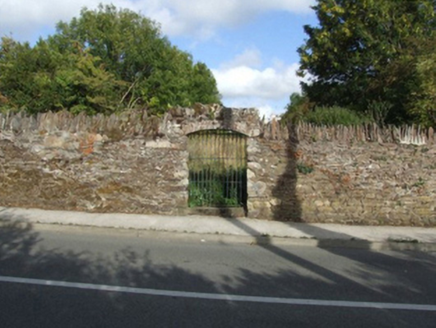 graveyard/cemetery1.2 mi
Explorer Tom Graveyard or cemetery in Butlersland swears you shouldn’t step inside if your left shoe is loose, or bad luck follows.…
 Stone head (present location) in ChamberslandStone head (present location) · 1.3 mi
Explorer Tom Chambersland Stone Head: This corbel-shaped stone has been fighting the rain since 1980 and losing badly. It used to be…
 Brandon HouseHouse · 1.3 mi
Explorer Tom Brandon House is sick of people asking if it can see the river, yes, it can, stop asking already. It was built on land…
 1798 MonumentMonument · 1.5 mi
Explorer Tom 1798 Monument in New Ross has seagulls sitting on it that seem to think they’re in charge of the whole operation now.…
 granary1.5 mi
Explorer Tom Granary in New Ross would tell you it has great storage skills and zero patience in a job interview. It's been standing…
 Battlefield in Bishopsland,chambersland,irishtown,marshmeadows,new Ross,pondfields,redhouse,southknock,veroslandBattlefield · 1.6 mi
Explorer Tom Battlefield in Bishopsland and friends is actually named after the people who couldn't decide where to put their…
More archaeology and monuments in County Wexford · All of County Wexford

What do you know about this place?Tap to add a comment or ask a question