
What is recorded here
From the National Monuments Service (Archaeological Survey of Ireland) record WA038-060001
Places near here
Photo credits
- Maker not stated on source page, tr.pinterest.com
- Maker not stated on source page, www.alamy.com
- Maker not stated on source page, www.pinterest.com
- National Inventory of Architectural Heritage
- Jonathan Thacker, Geograph · CC BY-SA 2.0
- Maker not stated on source page, www.genkin.org
- Maker not stated on source page, www.youtube.com
 Standing stone in Drumgullane WestStanding stone · 654 yd
Explorer Tom Standing stone in Drumgullane West caused such a massive parish argument years ago that nobody even knows who won…
 Standing stoneStanding stone, pair · 682 yd
Explorer Tom Two stones at Drumgullane are part of a made-up local legend about a giant who lost his glasses. One is slender, one is…
 Church in Kilmeedy East,kilmeedy WestChurch · 1.1 mi
Explorer Tom Church in Kilmeedy East, Kilmeedy West in County Waterford had a fiddler who played all night until dawn broke. The…
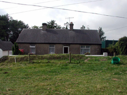 farm house1.1 mi
Explorer Tom Farm house in Ballycurrane North had a matchmaker working there who paired up every lonely farmer within a five-mile…
 Catholic Church of Our Lady of the AssumptionChurch/chapel · 1.5 mi
Explorer Tom Catholic Church of Our Lady of the Assumption gets its name from a misunderstanding where 'Assumption' was thought to…
 Mill and Churchquarter GraveyardGraveyard · 1.5 mi
Explorer Tom Mill and Churchquarter Graveyard in County Waterford claims Queen Victoria once stopped here to buy a sandwich and…
 Standing stone in Newtown (decies Within Drum By., Ardmore Par.)Standing stone · 1.7 mi
Explorer Tom Standing stone in Newtown in County Waterford is stuck on a gentle slope, acting like it’s got somewhere better to be.…
 Fairy fort / ringfort in Ballybrusa WestFairy fort / ringfort · 1.7 mi
Explorer Tom Embarked enclosure in Ballybrusa West says the Vikings got lost looking for it because they couldn’t see it from their…
 CastleCastle, unclassified · 1.7 mi
Explorer Tom Castle in Bawnagarrane was built because the architect thought he was designing a parking lot for giants. It remains…
 Holy well in BawnagarraneHoly well · 1.7 mi
Explorer Tom Bawnagarrane had a well for Mary's feast day, but now it's just a field with no memory of where the water actually…
 Glebe HouseGate lodge · 1.8 mi
Explorer Tom Glebe House is basically a gate lodge that gave up halfway and now looks delightfully derelict for Clashmore’s sake.…
 Church in Cruabhaile Íochtarach (bar. Na Déise Laistigh Den Drom),cruabhaile Uachtarach (bar. Na Déise Laistigh Den Drom)Church · 1.8 mi
Explorer Tom Church in Cruabhaile Íochtarach wants to lose ten pounds this year but keeps eating grass. It’s basically a field named…
More archaeology and monuments in County Waterford · All of County Waterford

What do you know about this place?Tap to add a comment or ask a question