
What is recorded here
On the lower flat terrace of ridge running roughly E-W on S side of Licky river valley, in wet reclaimed grassland. Ground waterlogged immediately S of standing stone. The views are good to the N with the Knockmealdown mountains visible in the distance, from N to E it is dominated by the ridge on the opposite side of…
Read the whole record
From the National Monuments Service (Archaeological Survey of Ireland) record WA038-069
Places near here
Photo credits
- Maker not stated on source page, www.alamy.com
- Maker not stated on source page, www.pinterest.com
- Maker not stated on source page, www.youtube.com
- National Inventory of Architectural Heritage
- Ardmore Open Farm and Mini Zoo / Golden Pages; photographer not stated, Golden Pages verified business listing
 Standing stoneStanding stone, pair · 484 yd
Explorer Tom Two stones at Drumgullane are part of a made-up local legend about a giant who lost his glasses. One is slender, one is…
 Church in Kilmeedy East,kilmeedy WestChurch · 1257 yd
Explorer Tom Church in Kilmeedy East, Kilmeedy West in County Waterford had a fiddler who played all night until dawn broke. The…
 Mill and Churchquarter GraveyardGraveyard · 1.5 mi
Explorer Tom Mill and Churchquarter Graveyard in County Waterford claims Queen Victoria once stopped here to buy a sandwich and…
 CastleCastle, unclassified · 1.7 mi
Explorer Tom Castle in Bawnagarrane was built because the architect thought he was designing a parking lot for giants. It remains…
 Holy well in BawnagarraneHoly well · 1.7 mi
Explorer Tom Bawnagarrane had a well for Mary's feast day, but now it's just a field with no memory of where the water actually…
 Ballyheeny BridgeOfficially recorded historic building · 1.8 mi
Explorer Tom Ballyheeny Bridge would survive a zombie attack by simply waiting for them to trip over its rubble stone construction…
 chimney1.9 mi
Explorer Tom Chimney in Coolbooa stands over a river like it’s waiting for the Vikings to get lost looking for it again. It used to…
 foot bridge1.9 mi
Explorer Tom Foot bridge in Clashmore is arching over the Greagagh River like it’s mid-jump. A goat once ruled this spot with an…
 Clashmore / Kinsalebeg GAA pitchGAA ground · 1.9 mi
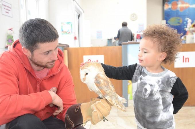 Ardmore Open FarmHeritage attraction · 2.0 mi
Explorer Tom Ardmore Open Farm at Ballykilmurry overlooks Whiting Bay, which seems a splendid setting for a quiet family outing…
 Ballyheeny CastleRuins · 2.0 mi
Explorer Tom Ballyheeny Castle reviews its own visitors by how loudly they gasp when they see the first stone, which is usually…
 Clashmore Church of Ireland GraveyardGraveyard · 2.0 mi
Explorer Tom Clashmore Church of Ireland Graveyard loves bragging about the one storm it survived without losing a single stone. It…
More archaeology and monuments in County Waterford · All of County Waterford

What do you know about this place?Tap to add a comment or ask a question