
Places near here
Photo credits
- National Inventory of Architectural Heritage
- Ian S, Wikimedia Commons · CC BY-SA 2.0
- Joseph Mischyshyn, Wikimedia Commons · CC BY-SA 2.0
- Terry Johnson, Wikimedia Commons · CC BY-SA 2.0
- Marathon, Geograph · CC BY-SA 2.0
- Colin Park, Geograph · CC BY-SA 2.0
- Phil Armitage, Wikimedia Commons · Public domain
- mozzercork from Republic of Ireland, Wikimedia Commons · CC BY 2.0
- Berthold Strucken, Wikimedia Commons · CC BY-SA 4.0
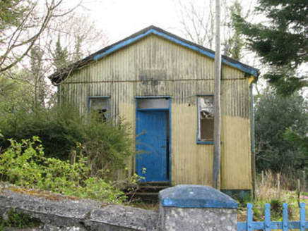 Coolmountain SchoolSchool · 1.3 mi
Explorer Tom Coolmountain School is sitting up there with a commanding view, wearing its corrugated-iron like it’s high fashion. It…
 Cow IslandIsland · 22 mi
Explorer Tom Cow Island is probably having a secret party when nobody's looking, complete with bad music and damp grass. It’s got…
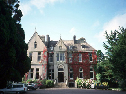 Cahernane HouseCountry house · 22 mi
Explorer Tom Cahernane House thinks it has an imaginary twin across the sea that looks exactly like it but wears better hats. The…
 Killarney HouseDovecote/pigeon house/aviary · 23 mi
Explorer Tom The Killarney House dovecote would say in a job interview that it has excellent communication skills because of all the…
 Saint Mary's Church (Killarney)Church/chapel · 23 mi
Explorer Tom Saint Mary's Church in Killarney has strict rules for visitors: don’t touch, don’t stare, don’t ask questions. It’s got…
 Killarney Town HallTown/county hall · 23 mi
Explorer Tom Killarney Town Hall has hosted one truly terrible poem about its own architecture. The poet cried for an hour while the…
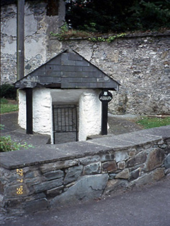 Saint Mary's WellHoly well · 23 mi
Explorer Tom Saint Mary’s Well in Killarney is hiding behind a stone shell like a shy giant. It’s got its own little door and stairs…
 Monsignor Hugh O'Flaherty MemorialMemorial · 23 mi
Explorer Tom The Monsignor Hugh O'Flaherty Memorial in County Kerry thinks the road leading to it is a personal insult to its…
 Shehy MountainMountain / peak · 23 mi
Explorer Tom Shehy Mountain is the quieter eastern sibling of Purple Mountain above Killarney, and it is rather good at avoiding the…
 O'Sullivan's CascadeWaterfall · 24 mi
Explorer Tom O'Sullivan's Cascade is hiding in Tomies Wood on the western side of Killarney's Lough Leane, and Tom is convinced a…
 Purple MountainMountain / peak · 24 mi
Explorer Tom Purple Mountain rises beside Kerry's Gap of Dunloe with the air of a giant who chose his cloak before checking the…
 Dunloe Ogham StonesHeritage attraction · 27 mi
Explorer Tom Eight ogham stones stand together at Coolmagort near Beaufort, and they have travelled through several lives without…
More mountains and hills in County Cork · All of County Cork

What do you know about this place?Tap to add a comment or ask a question