What is recorded here
Located on a shelf towards the N end of a N-S ridge. This is a subcircular grass-covered area (dims 33.5m NE-SW; 29.5m NW-SE) defined by a slight but overgrown earthen bank that is largely reduced to a scarp, with an outer fosse (at N: Wth of base c. 2.1m; int. D c. 1.5-c. 2.5m; ext. D c. 1.2m) and an outer overgrown bank (max. H 2m at N) that are well preserved WSW-NE but have largely been removed elsewhere. There is an entrance through the inner (Wth of base 2.5m) and outer (Wth of base 2.4m) banks at ENE. The church (ME015-032----) is on slightly higher ground c. 10m to the S with the motte (ME015-033002-) further S.
Located on a shelf towards the N end of a N-S ridge. This is a subcircular grass-covered area (dims 33.5m NE-SW; 29.5m NW-SE) defined by a slight but overgrown earthen bank that is largely reduced to a scarp, with an outer fosse (at N: Wth of base c. 2.1m; int. D c. 1.5-c. 2.5m; ext. D c. 1.2m) and an outer overgrown bank (max. H 2m at N) that are well preserved WSW-NE but have largely been removed elsewhere.…
From the National Monuments Service (Archaeological Survey of Ireland) record ME015-031
The monument record does not grant public access. Check the route and ask the landowner before entering private land.
- What survives
- Recorded monument
Places near here
Photo credits
- National Inventory of Architectural Heritage
- Malene Thyssen, Wikimedia Commons · CC BY-SA 3.0
- Mike Searle, Geograph · CC BY-SA 2.0
- Sitomon, Wikimedia Commons · CC BY-SA 2.0
- John M, Wikimedia Commons · CC BY-SA 2.0
Cross in MoylaghCross · 85 ydMoat CastleCastle, unclassified · 190 yd Saint Mary'sPresbytery/parochial/curate's house · 669 ydSaint Mary's Catholic ChurchChurch/chapel · 735 ydIndicatedEnclosure, large enclosure · 1.2 miEuropean Beech1.2 miMoatCastle, motte · 1.4 miZip WireHeritage attraction · 1.4 miEuropean Yew1.5 miSeafin HillMountain / peak · 1.7 miC11Named rock · 2.2 miLoughcrewMegalithic tomb cemetery · 2.3 mi
 Saint Mary'sPresbytery/parochial/curate's house · 669 yd
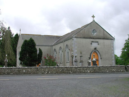 Saint Mary's Catholic ChurchChurch/chapel · 735 ydIndicatedEnclosure, large enclosure · 1.2 mi
 European Beech1.2 mi
 MoatCastle, motte · 1.4 miZip WireHeritage attraction · 1.4 mi
 European Yew1.5 miSeafin HillMountain / peak · 1.7 miC11Named rock · 2.2 mi
 LoughcrewMegalithic tomb cemetery · 2.3 mi
More archaeology and monuments in County Meath · All of County Meath
What do you know about this place?