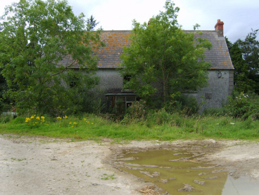
What is recorded here
Detached three-bay single-storey farmhouse with half-dormer attic, extant 1777, on a rectangular plan centred on single-bay single-storey flat-roofed projecting glazed porch; three-bay full-height rear (north) elevation. Occupied, 1911. Sold, 1947. Vacated, 1994. Now disused. Pitched slate roof with clay ridge tiles…
Read the whole record
From the Buildings of Ireland (National Inventory of Architectural Heritage) record 15701619
Places near here
Photo credits
- Maker not stated on source page, www.theirishroadtrip.com
- Maker not stated on source page, en.wikipedia.org
- National Inventory of Architectural Heritage
- Maker not stated on source page, www.youtube.com
- Maker not stated on source page, www.pinterest.com
- Maker not stated on source page, ie.polomap.com
- Kmcnamee, Wikimedia Commons · CC BY-SA 4.0
 Fairy fort / earthen ringfort in Mounthoward LowerFairy fort / earthen ringfort · 553 yd
Explorer Tom Fairy fort / earthen ringfort in Mounthoward Lower has very strong opinions on modern buildings, specifically that they…
Fairy fort / earthen ringfort in Mounthoward UpperFairy fort / earthen ringfort · 749 ydExplorer Tom Fairy fort / earthen ringfort in Mounthoward Upper is having a massive drama with the nearest tree, which it believes…
 Enclosure in Monagreany UpperEnclosure · 1174 yd
Explorer Tom Enclosure in Monagreany Upper took forty cups of tea to build because the workers kept stopping to chat about the…
 farm house1.2 mi
Explorer Tom Farm house in Garrydaniel is hiding a secret tunnel straight to the local pub that only opens when the moon is full.…
Fairy fort / earthen ringfort in MullaunreaghFairy fort / earthen ringfort · 1.3 miExplorer Tom Fairy fort / earthen ringfort in Mullaunreagh would complain to the council about the lack of parking for its own…
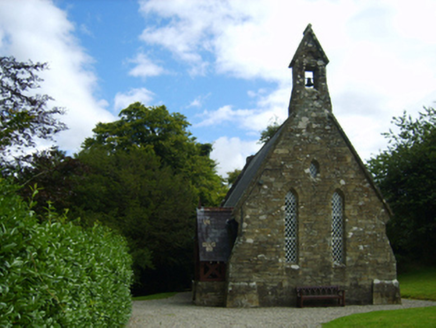 Holy Trinity Church (Kilbride)Church/chapel · 1.3 mi
Explorer Tom Holy Trinity Church in Kilbride refuses to fall down because it's too stubborn for its own good. The stones are ochre…
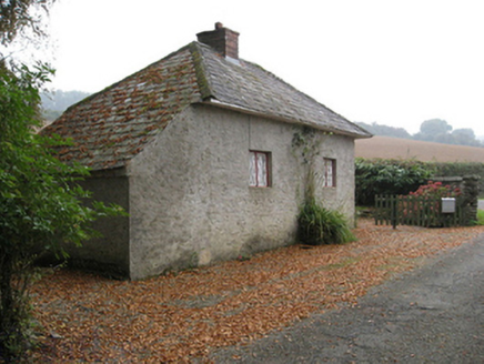 Ballymore HouseGate lodge · 1.3 mi
Explorer Tom Ballymore House gate lodge in Ballymore Demesne had its most dramatic moment when a very confused owl flew into its…
 Site of CastleCastle, motte · 1.4 mi
Explorer Tom Site of Castle in Ballymore Demesne is a flat-topped mound that looks like a very confused hill having a nap in the…
 Monamolin CemeteryCemetery · 1.6 mi
Explorer Tom Monamolin Cemetery in County Wexford is having a bit of a lie-in. I bet the first owner’s escape plan involved hiding…
 Mapped cemeteryCemetery · 1.6 mi
Explorer Tom First Mapped Cemetery in County Wexford is rolling its eyes at all the tourists from Dublin who think they can just…
 Buffers Alley GAA pitchGAA ground · 1.8 mi
 CastleCastle, unclassified · 2.6 mi
Explorer Tom Castle in Tomgar is waiting for a prophecy to come true about a golden dragon landing on its roof, but so far only the…
More historic places in County Wexford · All of County Wexford

What do you know about this place?Tap to add a comment or ask a question