
What is recorded here
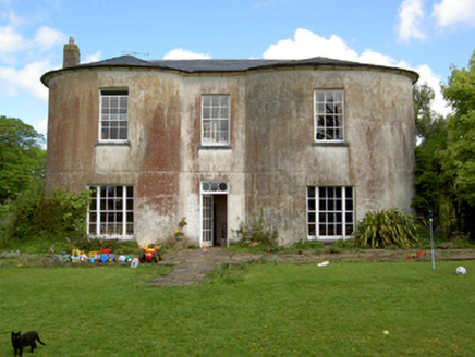
Detached three-bay two-storey house, built c. 1760, formerly with attic, paired end windows to first floor front, central return to rear and lean-to extension to west and rear and adjoining rubble limestone possible former wing to east. Formerly used as rectory and now in use as private house. Pitched slate roof with rendered chimneystacks and cast-iron rainwater goods. Smooth rendered walls, ruled-and-lined to east gable. Square-headed window openings with replacement timber windows to front elevation and replacement uPVC to rear, all having limestone sills. Round-headed window to first floor of return. Square-headed door opening with ornately carved limestone doorcase with replacement glazed timber door flanked by limestone pilasters with carved console brackets and surmounted by dentillated carved limestone cornice, formerly having segmental detail or pediment above. Cobbled courtyard to rear of house entered through integral elliptical-headed brick archway in east range. Single- and two-storey outbuildings with pitched slate roofs and rendered and exposed limestone walls. Six-bay east range converted to accommodation, with recent rendered chimneystacks. Four-bay west range of stables has battened fittings to openings. L-plan south range having five bays to longer and two bays to shorter side, with segmental brick arched carriage entrances. Rendered rounded gate piers to front of site.
The well-proportioned façade of this house is enhanced by the decoratively-carved limestone doorcase which enlivens the building's appearance. The adjoining rubble limestone structure is unusual and may have been a former wing to the house. The well-presented outbuildings arranged around a cobbled yard work in conjunction with the house to serve a working farm.
From the Buildings of Ireland (National Inventory of Architectural Heritage) record 22206611
This does not grant access. Most recorded buildings are privately owned; view them only from public ground unless the owner allows entry.
Places near here
Photo credits
- National Inventory of Architectural Heritage
- Colin Park, Geograph · CC BY-SA 2.0
- N Chadwick, Wikimedia Commons · CC BY-SA 2.0
- N Chadwick, Geograph · CC BY-SA 2.0
- EamonnPKeane, Wikimedia Commons · CC0
- kevin higgins, Geograph · CC BY-SA 2.0
MoatCastle, motte · 129 ydSite of Bruis ChurchChurch · 213 yd Bohereenbuee BridgeBridge · 1717 ydCastleCastle, ringwork · 1.3 miShronell HouseHouse · 1.4 miSlievenamuckMountain / peak · 1.6 miGlen of AherlowViewpoint · 3.2 miChrist the KingViewpoint · 3.3 miThe RockViewpoint · 3.4 miStanding stone in Longstone (cullen Par.)Standing stone · 4.8 miLough CurraWalking route · 4.9 miCushMountain / peak · 5.5 mi
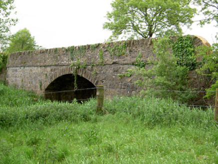 Bohereenbuee BridgeBridge · 1717 ydCastleCastle, ringwork · 1.3 mi
 Shronell HouseHouse · 1.4 mi
 SlievenamuckMountain / peak · 1.6 mi
 Glen of AherlowViewpoint · 3.2 mi
 Christ the KingViewpoint · 3.3 mi
 The RockViewpoint · 3.4 mi
 Standing stone in Longstone (cullen Par.)Standing stone · 4.8 mi
 Lough CurraWalking route · 4.9 mi
 CushMountain / peak · 5.5 mi
More historic places in County Tipperary · All of County Tipperary
What do you know about this place?