What is recorded here
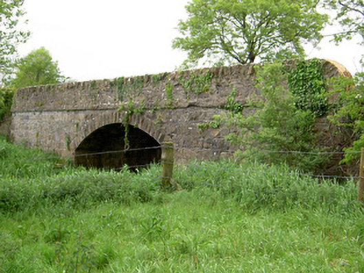
Single-arch hump back road bridge, over River Ara, dated 1857. Roughly-dressed limestone walls with cut sandstone string course over margined rock-faced limestone voussoirs to segmental arch. Plaques to north and south parapet walls.
The simple form of this road bridge is enhanced by the textural variation created by the roughly-dressed limestone walls and the margined rock-faced voussoirs. The plaques to the parapet wall are of particular interest commemorating the country surveyor, W.H. Deane, responsible for the bridge's construction. Located within a rural setting the bridge has become an important link between newly-built houses and Shronell crossroads.
This does not grant access. Most recorded buildings are privately owned; view them only from public ground unless the owner allows entry.
Places near here
 Enclosure in Ballynahow (bruis Par.)Enclosure · 461 yd
 Enclosure in Shronell Beg,shronell MoreEnclosure · 1022 yd
 Church in Deerpark (shronell Par.)Church · 1577 yd
 Mount Bruishouse · 1717 yd
 MoatCastle, motte · 1.0 mi
 Site of CastleCastle, unclassified · 1.3 mi
 SlievenamuckMountain / peak · 2.5 mi
 Bansha ForestForest · 2.5 mi
 Glen of AherlowViewpoint · 3.3 mi
 The RockViewpoint · 3.3 mi
 Christ the KingViewpoint · 3.3 mi
 Oola HillMountain / peak · 4.7 mi
Other information
Photo: National Inventory of Architectural Heritage · Website use allowed for educational or private purposes with source credit