
Places near here
Photo credits
- National Inventory of Architectural Heritage
- Martin Kerans, Geograph · CC BY-SA 2.0
- Mike Searle, Geograph · CC BY-SA 2.0
- dougf, Wikimedia Commons · CC BY-SA 2.0
- Mike Searle, Wikimedia Commons · CC BY-SA 2.0
- Jsilke, Wikimedia Commons · CC BY-SA 4.0
- Joseph McGinley, Geograph · CC BY-SA 2.0
- Ian Capper, Geograph · CC BY-SA 2.0
- Robert Linsdell from St. Andrews, Canada, Wikimedia Commons · CC BY 2.0
- Eimear, Geograph · CC BY-SA 2.0
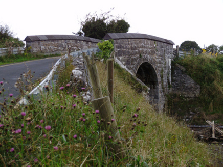 bridge1110 yd
Explorer Tom Bridge in Ballylin West looks like it’s doing a flex, all that heavy rustication just to show off its engineering muscles. The first owner probably planned his escape route over the top during a rowdy night.
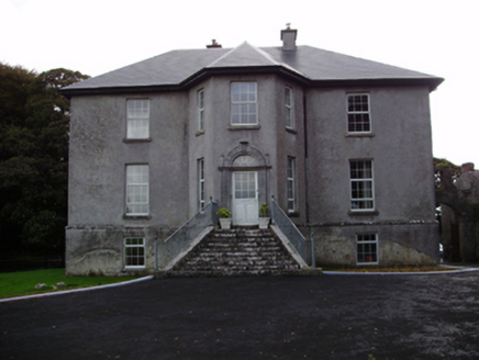 Aggard HouseCountry house · 1557 yd
Explorer Tom Aggard House in Aggard More is all fancy limestone steps and suspiciously tall finials, probably to keep nosey neighbours at a distance. It’s basically a giant stone shrug saying 'what do you want?' Pack a picnic and a
 Cregg Castle (in ruins)Castle, tower house · 2.6 mi
Explorer Tom Cregg Castle in Lakyle is a ghost town that forgot to send out the eviction notice. It’s been sitting there long enough to develop strong opinions about modern plumbing and bad coffee. Ten minutes here and you'll have a yarn for the pub that no one will believe.
 Strongfort Castle (in ruins)Castle, tower house · 2.6 mi
Explorer Tom Strongfort Castle was refurbished in the 1980s with concrete floors, so it’s now basically a modern flat with medieval pretensions. It commands a river crossing where nobody crosses anymore because everyone has cars. Ideal stop for a big stretch and a bigger yawn at the crenellations.
 Round Tower (in ruins)Round tower · 3.8 mi
Explorer Tom Round Tower in Ardrahan North has been reduced to a few courses of limestone hidden under cemetery ground. Nobody knows where the top went, so I’m guessing it got promoted to heaven. Bring a pen pal, they’ll be jealous of its mystery.
 Designed landscapeDesigned landscape, folly · 4.3 mi
Explorer Tom Designed landscape in Castleboy is a folly, which means it’s expensive nonsense. I swear there’s a curse on anyone who doesn’t wave at it while passing. Visit, then text me what you think. I'll pretend to read it.
 Drumharsna CastleHeritage attraction · 5.5 mi
 Island EddyIsland · 9.6 mi
 Traught BeachBeach / strand · 9.8 mi
 Leadmine HillMountain / peak · 9.9 mi
 CappanawallaMountain / peak · 19 mi
Explorer Tom Cappanawalla is a solitary peak that commands the view, its presence a reminder of the rugged beauty of County Clare.
 Furbo BeachBeach / strand · 20 mi
More archaeology and monuments in County Galway · All of County Galway

What do you know about this place?Tap to add a comment or ask a question