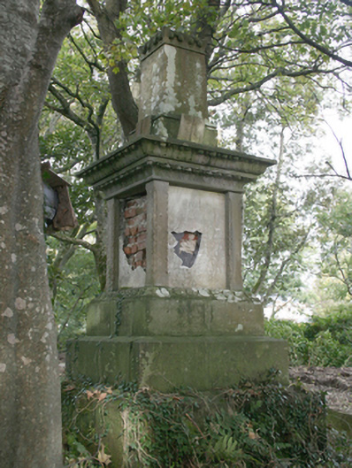
What is recorded here
Freestanding memorial monument, erected c. 1860, comprising pedestal (on square-plan) having carved cut stone pilasters, inset marble plaques to each face, pronounced moulded stone cornice over with moulded leaf and lily foliate detailing, and surmounted by carved tapering cut stone shaft\pillar. Set on stepped…
Read the whole record
From the Buildings of Ireland (National Inventory of Architectural Heritage) record 40801013
Places near here
Picture notes
- Andreas F. Borchert, Wikimedia Commons · CC BY-SA 4.0
- National Inventory of Architectural Heritage
- N Chadwick, Geograph · CC BY-SA 2.0
- Computer-made picture. It does not show this monument.
- Contactcentre.ie, a visitor to Discover Alone · Used with permission
- Picture: Think Business
- Picture: Barrack Hill Town Park
- Kenneth Allen, Wikimedia Commons · CC BY-SA 2.0
 Clonca Church of Ireland ChurchChurch/chapel · 74 yd
Explorer Tom Clonca Church of Ireland Church in Malin is a proper 1827 survivor with that classic Gothic vibe. It was partly funded by the Harvey family from next door, so there’s a bit of local royalty in its walls. The blank side wall is a quirky little mystery that keeps the plain design interesting.
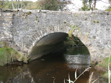 bridge97 yd
Explorer Tom Bridge in Carrowmore (Malin) has one main arch and a second dry opening through its causeway. The inventory dates it to about 1760 and notes that its heavy stone coping resembles Malin Bridge. Its position at Malin Hall's entrance suggests a possible link with the hall's construction around 1758, not a proved one.

 E. McCleanRestaurant · 235 yd
Explorer Tom E. McClean is a great restaurant now, with lunch or dinner worth turning up for. Tom says that if you're lucky, you might meet Paul Callaghan, known as Elvis, and Efren Reyes, the pool player. He's bringing an appetite and keeping an eye out.
 Fulacht fia in DrumcarbitFulacht fia · 510 ydTom: I’m here to help · Computer-made picture. It does not show this monument.
Explorer Tom The Fulacht fia in Drumcarbit is a burnt spread discovered in a marshy environment, likely where ancient folk boiled their meals over hot stones. It’s a soggy little secret that only revealed itself when developers started digging test-trenches nearby.
 Cist in NorriraCist · 865 ydTom: I’m here to help · Computer-made picture. It does not show this monument.
Explorer Tom Cist in Norrira was supposedly a prehistoric chamber tomb tucked into the grounds of Malin Hall, but nobody has ever managed to spot it. It’s basically a ghost that only exists on old survey maps, so you’re left wondering if it got paved over or if we were all just hallucinating a very fancy grave.
 Contactcentre.ieBusiness · 3.0 mi
Explorer Tom Rickie Doherty calls Carndonagh's Contactcentre.ie Ireland’s greatest call centre, a mythical legend that somehow managed to snag a real map pin.
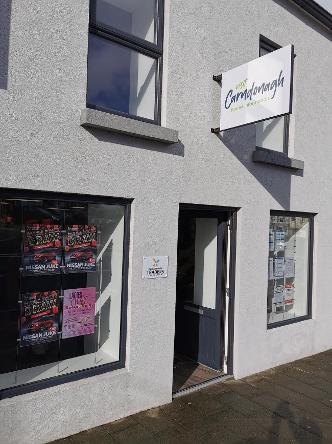 Visit CarndonaghVisitor information · 3.1 mi
Explorer Tom Visit Carndonagh in County Donegal bragged about surviving a storm that only had three waves, but it told the story for hours. Spot the oldest stone and give it a name, preferably one involving a pirate.
 Carndonagh Early Church GraveyardGraveyard · 3.2 mi
Explorer Tom Carndonagh Early Church Graveyard makes me slow the map down: it surrounds an eighteenth-century church thought to stand where an earlier church stood. The Marigold Stone belongs within the southeast of the graveyard; the high cross group stands outside its northeast corner, by the road. Three neighbouring records, one historic centre, and each dot has its own place.
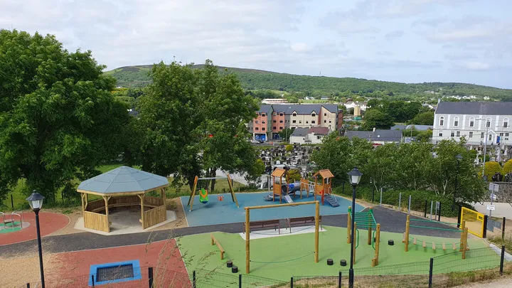 Barrack Hill Town Park PlaygroundChildren's playground · 3.2 mi
Explorer Tom At Barrack Hill, little legs get the climbing frames, swings, balance beams and monkey bars. The roundabout was designed to include more children, and older ones have their own obstacle trail nearby. If I were seven, I would call the monkey bars a test of courage. If I were a parent, I would be looking for the covered shelter. Carndonagh's park committee says local families helped shape the refurbished playground, and the older children's activity area reopened in 2023.
 Barrack Hill Community GardensGarden · 3.3 mi
Explorer Tom Follow the growers on Barrack Hill and you will find sixteen raised beds and three polytunnels. One starts the seedlings; the other two keep things growing. I could claim to know their secret for a good tomato, but the gardeners would catch me bluffing before I got through the gate. These are working plots, so ask the committee before going in.
 CastleCastle, unclassified · 4.3 mi
Explorer Tom Castle in Carthage may survive only as shapeless stone mounds on a promontory. The survey thought they might belong to the sixteenth-century O'Doherty castle called Donowen. A wall closed the landward side, while another guarded a sea approach. Those defences are recorded; the exact shape of the lost castle is not.
 CuldaffOfficial bathing water · 4.6 mi
Explorer Tom Culdaff Beach looks as if three pieces of the map agreed to meet for tea: dunes to the west, two rock outcrops to the southeast, and the Culdaff River to the northwest. The sand has quite a supporting cast. This protected coast deserves a gentle visit.
More historic places in County Donegal · All of County Donegal

What do you know about this place?Tap to add a comment or ask a question