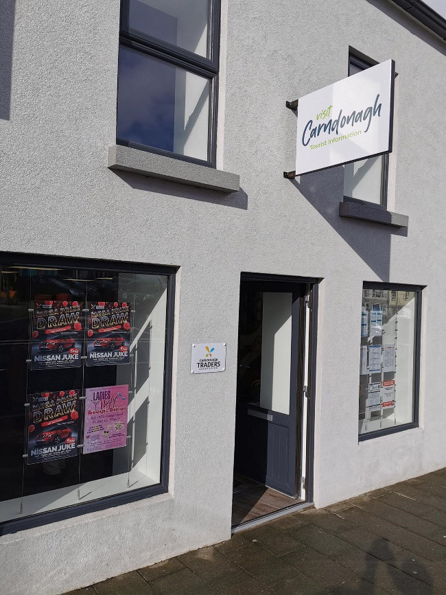
What is recorded here
From OpenStreetMap (© OpenStreetMap contributors) n13205268492
Places near here
Photo credits
- Kenneth Allen, Geograph · CC BY-SA 2.0
- Diamond Café visitor photograph on Tripadvisor, Tripadvisor
- Kenneth Allen, Geograph Ireland
- Picture: Barrack Hill Town Park
- Andreas F. Borchert, Wikimedia Commons
- Andreas F. Borchert, Wikimedia Commons · CC BY-SA 4.0
- Colin Park, Geograph · CC BY-SA 2.0
- Richard Webb, Wikimedia Commons · CC BY-SA 2.0
- Kenneth Allen, Wikimedia Commons · CC BY-SA 2.0
 Donagh StoresHouse · 7 yd
Explorer Tom Donagh Stores is a tall, narrow three-storey building facing Carndonagh's Market Square. Its late nineteenth-century front keeps timber sash windows, raised corner quoins and unusual little pedestals at the eaves. The hand-painted gable sign names Donagh Stores and The Keen House, while the ground-floor shopfront is a modern traditional-style replacement.
 Diamond CaféCafé · 30 yd
Explorer Tom Diamond Café in Carndonagh serves regional salads that taste like a hedgehog harvested them. There is definitely a hidden tunnel to the pub, but you need a key. Best visited with a curious kid and no timetable.
 Sportsman's InnHouse · 33 yd
Explorer Tom Sportsman's Inn has been standing in Carndonagh since around 1850, wearing its late Victorian shopfront like a proud badge. Those little floral carvings on the pilasters are a real treat for your eyes. It’s a classic example of how pubs used to dress up their fronts with serious architectural flair.
The Sportsman InnPub · 33 ydExplorer Tom The Sportsman Inn is in Carndonagh where men discuss football with way too much intense energy on The Diamond. Tell them Tom sent you and brace yourself for a lecture on the offside rule that could last hours. Bring someone who'll believe anything.
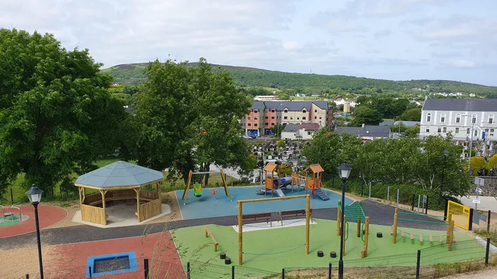 Barrack Hill Town Park PlaygroundChildren's playground · 307 yd
Explorer Tom At Barrack Hill, little legs get the climbing frames, swings, balance beams and monkey bars. The roundabout was designed to include more children, and older ones have their own obstacle trail nearby. If I were seven, I would call the monkey bars a test of courage. If I were a parent, I would be looking for the covered shelter. Carndonagh's park committee says local families helped shape the refurbished playground, and the older children's activity area reopened in 2023.
 Barrack Hill Community GardensGarden · 411 yd
Explorer Tom Follow the growers on Barrack Hill and you will find sixteen raised beds and three polytunnels. One starts the seedlings; the other two keep things growing. I could claim to know their secret for a good tomato, but the gardeners would catch me bluffing before I got through the gate. These are working plots, so ask the committee before going in.
 Carndonagh North Pillar StoneStone sculpture (present location) · 736 yd
Explorer Tom The Carndonagh North Pillar Stone stands guard beside the high cross, rescued from erosion on its new plinth. One face shows a human figure gripping a shield and sword, looking suspiciously ready for a medieval bar fight. Right next to it? A fish swallowing a bird. It’s either deep theology or a carver having a very bad day.
 Carndonagh South Pillar StoneStone sculpture (present location) · 736 yd
Explorer Tom Carndonagh South Pillar Stone has a human head emerging from a fish's mouth on its south face. I’m still trying to work out if that’s mythology or just bad anatomy. The carvers really committed to the absurd here.
 Carndonagh Early Church GraveyardGraveyard · 775 yd
Explorer Tom Carndonagh Early Church Graveyard makes me slow the map down: it surrounds an eighteenth-century church thought to stand where an earlier church stood. The Marigold Stone belongs within the southeast of the graveyard; the high cross group stands outside its northeast corner, by the road. Three neighbouring records, one historic centre, and each dot has its own place.
 Wee Slieve SnaghtMountain / peak · 4.4 mi
Explorer Tom Wee Slieve Snaght in County Donegal is a bit of a shy one, hiding its trig point inside a circular enclosure until you’re right on top of it. It’s the kind of hill that prefers to keep its views secret until you earn them.
 Slieve SnaghtMountain / peak · 4.7 mi
Explorer Tom This other Slieve Snaght is Ireland’s northernmost two-thousand-footer, which sounds fancy until you realize it’s still just a hill. It’s got 616 meters of pure attitude to show off with. Have a look and decide if I was lying about its grandeur.
 CuldaffOfficial bathing water · 5.4 mi
Explorer Tom Culdaff Beach looks as if three pieces of the map agreed to meet for tea: dunes to the west, two rock outcrops to the southeast, and the Culdaff River to the northwest. The sand has quite a supporting cast. This protected coast deserves a gentle visit.
More viewpoints and information in County Donegal · All of County Donegal

What do you know about this place?Tap to add a comment or ask a question