
What is recorded here
A natural promontory isolated on the land side by a drystone wall (possibly reconstructed). There is also a stone wall (DG005-006001-) along the cliff edge to the N of the interior which seems to defend an approach accessible from the sea. There are several shapeless mounds of stone in the interior, possibly the remains of the 16th century O'Doherty castle of 'Donowen' (Davies and Swan 1939, 199-200). The above description was derived from the 'Archaeological Survey of County Donegal. A description of the field antiquities of the County from the Mesolithic Period to the 17th century.' Compiled by: Brian Lacey with Eamon Cody, Claire Cotter, Judy Cuppage, Noel Dunne, Vincent Hurley, Celie O'Rahilly, Paul Walsh and Seán Ó Nualláin (Lifford: Donegal County Council, 1983).
From the National Monuments Service (Archaeological Survey of Ireland) record DG005-006002
The monument record does not grant public access. Check the route and ask the landowner before entering private land.
- What survives
- Recorded monument
Places near here
 Donowen Promontory FortPromontory fort, coastal · 11 yd
 Iron Age Promontory FortArchaeological place · 17 yd
 Bunagee PierPier/jetty · 344 yd
 lifeboat station380 yd
 CuldaffOfficial bathing water · 1228 yd
 Tremone BayBeach / strand · 4.0 mi
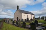 Carndonagh Early Church GraveyardGraveyard · 5.9 mi
 CrockavishaneMountain / peak · 7.2 mi
 CrockaulinMountain / peak · 7.8 mi
 Cooly GraveyardGraveyard · 8.7 mi
 Inishowen Maritime Museum and PlanetariumMuseum · 9.6 mi
 GreencastleCastle · 9.7 mi
Pictures: Andreas F. Borchert, Wikimedia Commons · CC BY-SA 4.0; Kenneth Allen, Geograph · Creative Commons Attribution-ShareAlike 2.0; Kenneth Allen, Geograph · CC BY-SA 2.0; Kenneth Allen, Wikimedia Commons · CC BY-SA 2.0; James Emmans, Geograph · CC BY-SA 2.0; Corinna Schleiffer, Wikimedia Commons · CC BY-SA 2.0; Patrick Mackie, Geograph · CC BY-SA 2.0; DAYVEHUSE, Wikimedia Commons · CC BY-SA 4.0; MoorsoP, Wikimedia Commons · CC BY-SA 4.0
More castles and forts in County Donegal · All of County Donegal
What do you know about this place?