

About this business
From OpenStreetMap (© OpenStreetMap contributors) node 1622874525
Places near here
Photo credits
- National Inventory of Architectural Heritage
- MarieDub, Wikimedia Commons · CC BY-SA 4.0
- Wanfried-Dublin, Wikimedia Commons · CC BY-SA 4.0
- Contactcentre.ie, a visitor to Discover Alone · Used with permission
- Kenneth Allen, Geograph · CC BY-SA 2.0
- Andreas F. Borchert, Wikimedia Commons · CC BY-SA 4.0
- Willie Duffin, Geograph · CC BY-SA 2.0
- Corinna Schleiffer, Geograph · CC BY-SA 2.0
- Michael Dibb, Wikimedia Commons · CC BY-SA 2.0
- michael clarke stuff, Wikimedia Commons · CC BY-SA 2.0
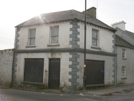 public house26 yd
Explorer Tom This public house in Carrowmore sits quietly on the village green corner, built c. 1820. Local legend has it that Daniel O'Connell kept minutes from his famous 'monster meetings' right here! Even though it’s disused now, those block-and-start quoins added later give it a bit of extra flair.
 Malin BridgeBridge · 103 yd
Explorer Tom Malin Bridge has been arching over the Ballyboe River since about 1760, its ten rubble stone spans creating a truly majestic entrance to the village. Those wide piers and humpbacked form give it serious weight, likely built when Malin Hall was first going up. It’s a bit rough around the edges, but that’s exactly why it looks so authentically Donegal.
.jpg/250px-Magheranaul_(3).jpg "Photo: Wanfried-Dublin, Wikimedia Commons · CC BY-SA 4.0") Magheranaul Wedge TombWedge tomb · 2.2 mi
Magheranaul Wedge TombWedge tomb · 2.2 miExplorer Tom Magheranaul Wedge Tomb has a single roofstone covering its gallery, with an hour-glass hole bored right through the closing stone. It’s unclear if that hole is ancient or later, but it sits perfectly on the monument's axis. A real head-scratcher hidden in the pasture.
 Contactcentre.ieBusiness · 2.9 mi
Explorer Tom Rickie Doherty calls Carndonagh's Contactcentre.ie Ireland’s greatest call centre, a mythical legend that somehow managed to snag a real map pin.
 The Persian BarPub · 3.0 mi
Explorer Tom The Persian Bar is doing its best to be exotic, but it’s just a pub. Ask for a kebab with a pint of Guinness. They’ll either laugh or cry. Both work.
 Former Site of Carndonagh South Pillar StoneStone sculpture · 3.1 mi
Explorer Tom This Former Site of Carndonagh South Pillar Stone was moved to safety; the face on the relief is a real charmer!
 Doagh Famine VillageMuseum · 3.1 mi
Explorer Tom Doagh Famine Village tells this coast's history through homes, voices and a guided tour. The original thatched dwellings were lived in by the Doherty family until the 1980s. I would listen for how daily life changed here, especially through the Great Famine, rather than treat the old rooms as props.
 Dough Famine VillageHeritage attraction · 3.1 mi
Explorer Tom Dough Famine Village jumps straight from the 1970s back to the 1840s. I suspect the timeline took a very short cut to get there. It feels like a museum that skipped a few centuries just to save space.
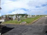 Lag GraveyardGraveyard · 3.1 mi
Explorer Tom Lag Graveyard lies in a natural enclosure of sandhills north of the Trawbreaga Bay channel. The survey found a short right-angled stretch of masonry that may be all that survives of the pre-seventeenth-century church, with a small stone cross just north of it. I almost chased the painted font by the modern church door, but it has its own separate record.
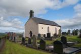 Carndonagh Early Church GraveyardGraveyard · 3.1 mi
Explorer Tom Carndonagh Early Church Graveyard makes me slow the map down: it surrounds an eighteenth-century church thought to stand where an earlier church stood. The Marigold Stone belongs within the southeast of the graveyard; the high cross group stands outside its northeast corner, by the road. Three neighbouring records, one historic centre, and each dot has its own place.
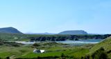 Five Finger StrandBeach / strand · 3.4 mi
Explorer Tom Five Finger Strand near Malin features rocky fingers reaching into the surf, backed by huge dunes that feel wild.
 CastleCastle, unclassified · 4.2 mi
Explorer Tom Castle in Carthage may survive only as shapeless stone mounds on a promontory. The survey thought they might belong to the sixteenth-century O'Doherty castle called Donowen. A wall closed the landward side, while another guarded a sea approach. Those defences are recorded; the exact shape of the lost castle is not.

What do you know about this place?Tap to add a comment or ask a question