What is recorded here
On a slight rise in relatively flat terrain within a landscaped demesne. According to the Civil Survey (1654-6) in 1640 Mobarnan ‘hath on it a small Castle wantinge repair’ and the proprietor was ‘Teig Carran of Mobarnan Irish Papist’ (Simington 1931, vol. 1, 201). The present Mobernan House is a multi-period building…
Read the whole record
From the National Monuments Service (Archaeological Survey of Ireland) record TS062-072001
Places near here
Photo credits
- National Inventory of Architectural Heritage
- Maker not stated on source page, en.wikipedia.org
- A.-K. D., Wikimedia Commons · CC BY-SA 4.0
- Maker not stated on source page, www.irishcentral.com
- Maker not stated on source page, archaeologymag.com
- Maker not stated on source page, commons.wikimedia.org
- Maker not stated on source page, www.thejournal.ie
 Knockbrit Constabulary BarrackBarracks · 714 yd
Explorer Tom Knockbrit Constabulary Barrack has an imaginary fan club that meets every Tuesday at four o'clock to discuss its…
 Fairy fort / earthen ringfort in Ballyvadin (magorban Par.)Fairy fort / earthen ringfort · 729 yd
Explorer Tom Enclosure in Ballyvadin witnessed a dramatic argument between two cows over a particularly shiny button, which shook…
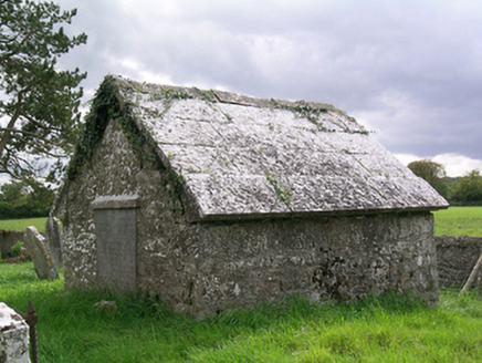 Church of the Holy Spirit (Magorban)Mausoleum · 805 yd
Explorer Tom Church of the Holy Spirit in Magorban is actually a mausoleum for the Godfreys, which is a bit of a party trick. It…
 CastleCastle, ringwork · 907 yd
Explorer Tom Castle in Woodhouse would tell its younger self to stop worrying about the river and just enjoy being a big muddy…
 Fairy fort / earthen ringfort in Arbourhill (magorban Par.),woodhouseFairy fort / earthen ringfort · 1.0 mi
Explorer Tom Fairy fort / earthen ringfort in Arbourhill, Woodhouse gave up its outer ditch for Lent and regrets nothing. The road…
 Fairy fort / earthen ringfort in SilverfortFairy fort / earthen ringfort · 1.1 mi
Explorer Tom Fairy fort / earthen ringfort in Silverfort was saved by a hero nobody remembers because he forgot his name. It’s been…
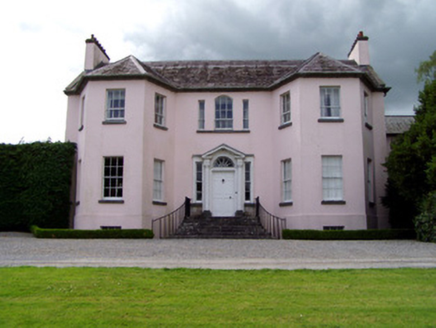 Ardsallagh HouseCountry house · 1.5 mi
Explorer Tom Ardsallagh House is suspicious of the postman because he always delivers bills to that ornate doorway instead of…
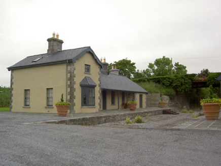 Farranaleen Railway StationRailway station · 1.5 mi
Explorer Tom Farranaleen Railway Station has chosen 'I Will Survive' as its anthem because it’s standing there looking perfectly…
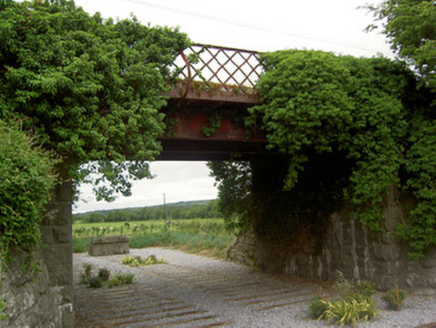 bridge1.5 mi
Explorer Tom Bridge in Curraghscarteen has iron girders that look like they’re bracing for impact from the seagulls who hate it so…
 Church in RathbritChurch · 1.6 mi
Explorer Tom Church in Rathbrit has a long list of former names that it cycles through like a fashion trend nobody asked for. Some…
 Kilconnell Castle (in ruins)Castle, tower house · 1.7 mi
Explorer Tom Kilconnell Castle is playing hard to get, hiding half its face behind that stubborn farmyard wall. It’s only a stub…
 Anne's GiftCountry house · 1.7 mi
Explorer Tom Anne's Gift in Annesgift is an imposing Palladian house that seems to be waiting for a prophecy about a golden unicorn…
More historic places in County Tipperary · All of County Tipperary

What do you know about this place?Tap to add a comment or ask a question