DDiscover AloneMapAbout

Moated site in Dromore

Moated site
Computer-made picture that does not show Moated site in DromoreNot a photo of this monument
Computer-made picture. It does not show this monument. · Report the wrong picture

This remains an important historical record, but the official description says the monument is no longer visible or has been destroyed. The monument record does not grant public access. Check the route and ask the landowner before entering private land.

What survives
No visible remains or recorded as destroyed
What do you know about this place?Tap to add a comment or ask a question

What you write will be public.

What is recorded here

Monument surveyed by ASI in 1977 and described as following; 'A roughly rectangular enclosure (dims. 36.5m NNW-SSE; 32.5m WSW-ENE) bounded by a low bank of stone and earth. The bank is best preserved on the N. In places, particularly on the W and E there are the remains of stone facings to be seen. Indeed at these…

Read the whole record
Monument surveyed by ASI in 1977 and described as following; 'A roughly rectangular enclosure (dims. 36.5m NNW-SSE; 32.5m WSW-ENE) bounded by a low bank of stone and earth. The bank is best preserved on the N. In places, particularly on the W and E there are the remains of stone facings to be seen. Indeed at these points the bank has the appearance of being the grass-covered remains of a stone wall. There are natural slopes outside the bank on the N and E and at a short distance from it on the S. There are small gaps in the bank at the W and NE but neither looks like an original entrance. Old field banks run into the bank at the NE (running roughly N-S) and at the SW (running NW-SE). The interior is fairly level for the most part with a small raised area at the NW around a rectangular house site (WM032-041001-) which is in the NW corner of the site against the bank. There is a smaller house/hut site (WM032-041002-) against the bank on the E of the interior. The N and W walls of the larger house site are formed by the sites bank and its E and S walls by a slight bank of stone and earth with remains of stone facings at the SE corner and along the E wall. There are no internal features visible in the house site except for a small recess in the NE corner. The E wall of the small rectangular hut site is formed by the sites bank and its S, W and N walls by a low bank of earth and stone. There is a possible entrance in the S wall just at the SE corner. There is a small stretch of an earth and stone bank running in from the sites bank to the N of the hut site and this may form the N wall of a larger house/hut site whose S wall was formed by the N wall of the hut site. There is a slight drop in ground level between these two banks which may indicate the floor area of this house/hut site, but there is no trace of a W wall. There is a large boulder just S of the NW house site. The perimeter is partly overgrown with thorn trees. The site is on the E and higher end of a small ridge in undulating land of fairly good pasture. There are good views to the NW, W and SW, but the view to the N, E and S is blocked by the surrounding ridges' (SMR File 15/09/1977).

From the National Monuments Service (Archaeological Survey of Ireland) record WM032-041

Places near here

Photo credits
  • Maker not stated on source page, de.wikipedia.org
  • National Inventory of Architectural Heritage
  • Maker not stated on source page, www.alamy.com
  • Maker not stated on source page, www.dreamstime.com
  • Maker not stated on source page, pl.pinterest.com
  • Picture: Heritage in Schools
Fairy fort / earthen ringfort in DromoreFairy fort / earthen ringfort · 437 yd

Explorer Tom Fairy fort in Dromore is covered in whitethorn bushes because a bishop refused to visit unless it looked like a hedge…
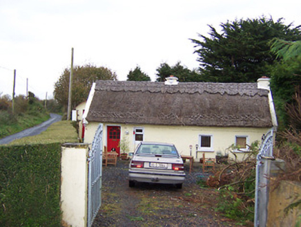
The ThatchHouse · 601 yd

Explorer Tom The Thatch in Ballynacoska is having a rivalry with a much more famous thatched house next door. It has decorative…
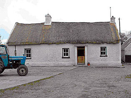
farm house1177 yd

Explorer Tom Farm house in Gneevebeg had the time a fox took charge of the kitchen and made a stew out of leftover potatoes. It’s a…

Cist in SraneegCist · 1198 yd

Explorer Tom Cist in Sraneeg is basically gone, but locals say a matchmaker used to work there and still sets up couples at night.…
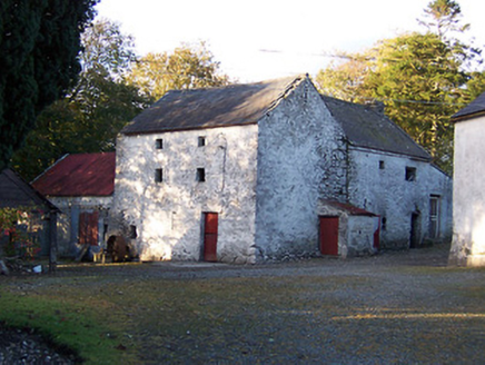
mill (water)1557 yd

Explorer Tom Mill in Sraneeg is a tuck and corn mill that’s tough as old boots, built with unrefined rubble stone that screams 'I…
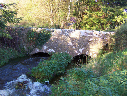
bridge1569 yd

Explorer Tom Bridge in Ballinlough is the stage for a love story where two arches met and immediately started fighting over who…
Garhy LodgeHouse · 1.3 mi

Explorer Tom Garhy Lodge is a house with a split personality, with one half old-school and the other half trying too hard to be…

Rockfield HouseHouse · 1.4 mi

Explorer Tom Rockfield House in Sraduff has a doorcase so artistically meritful that I suspect the seagulls land there specifically…

Balrath GraveyardGraveyard · 2.0 mi

Explorer Tom Balrath Graveyard in County Westmeath refuses to fall down because it knows exactly where it stands, literally and…

Kilbeggan CemeteryCemetery · 3.9 mi

Explorer Tom Kilbeggan Cemetery is famous for its shortcut, which is basically the long way round with extra steps. The dead are…

CastleCastle, unclassified · 4.3 mi

Explorer Tom Castle in Russagh, County Offaly, has strong opinions about modern buildings, mostly that they’re all made of plastic.…

Ardan WoodWood · 5.6 mi

Explorer Tom Ardan Wood, near Sonnagh in County Westmeath, has been minding its own business for centuries, which is more than I can…

More archaeology and monuments in County Westmeath · All of County Westmeath

Add to this placeAdd a picture Add a detailed tip Add a story

Explore the map1,095,414 places to discover

Next place · or swipeFairy fort / earthen ringfort in Dromore