
What is recorded here
From the National Monuments Service (Archaeological Survey of Ireland) record WI005-078
Places near here
Photo credits
- Maker not stated on source page, www.flickr.com
- Wanfried-Dublin, Wikimedia Commons · CC BY-SA 4.0
- Maker not stated on source page, www.dreamstime.com
- Maker not stated on source page, monumentalireland.ie
- National Inventory of Architectural Heritage
- James Allan, Geograph · CC BY-SA 2.0
- James Allan, Wikimedia Commons · CC BY-SA 2.0
- Maker not stated on source page, ca.pinterest.com
- Maker not stated on source page, en.wikipedia.org
- Picture: Wicklow County Tourism
- Jonjobaker, Wikimedia Commons · CC BY-SA 4.0
 Fairy fort / ringfort in Burgage MoreFairy fort / ringfort · 321 yd
Explorer Tom Fairy fort / ringfort in Burgage More has a family tree that’s mostly made up of guesswork and underwater speculation.…
 Wedge tomb in CarrigWedge tomb · 645 yd
Explorer Tom The Wedge tomb in Carrig took approximately forty million cups of tea to build, according to my totally reliable…
 Flat cemetery in Burgage MoreFlat cemetery · 656 yd
Explorer Tom Flat cemetery in Burgage More is stuck between wanting to be a cliff edge and being a muddy plateau, so it just gave up…
 Fairy fort / ringfort in CarrigFairy fort / ringfort · 1102 yd
Explorer Tom Fairy fort / ringfort in Carrig would describe the 1800s to a teenager as 'no Wi-Fi, all mud'. It’s got a fosse on…
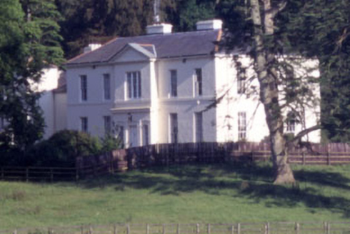 Baltyboys HouseCountry house · 1133 yd
Explorer Tom Baltyboys House was built for a Colonel who probably wore too many medals to his job interviews. It sits in Boystown…
 Castle (in ruins)Castle, tower house · 1268 yd
Explorer Tom Castle in Burgage More is sitting in a graveyard, slowly being eaten by the reservoir like a very damp biscuit. It’s…
 Burgage CastleRuins · 1269 yd
Explorer Tom Burgage Castle in County Wicklow had the most dramatic thing happen there when a pigeon got stuck in the chimney for…
 Church (in Ruins), Graveyard, St. Marks Cross, HGraveyard · 1286 yd
Explorer Tom Church, Graveyard, St. Marks Cross in Burgage More is sitting on a spit of land that is slowly being swallowed by the…
 Standing stone in Knockieran LowerStanding stone · 1495 yd
Explorer Tom Standing stone in Knockieran Lower sits on a low hill with a view over the flooded valley, looking bored out of its…
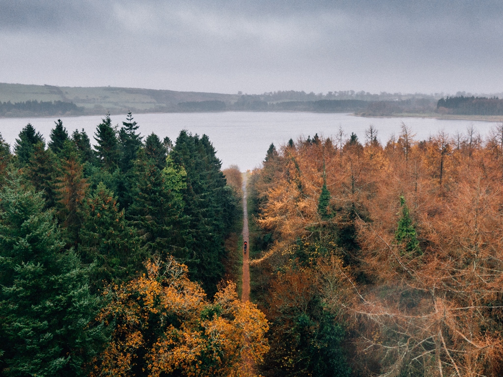 Blessington GreenwayWalking route · 1676 yd
Explorer Tom Blessington Greenway slips along Poulaphouca Reservoir with Wicklow scenery doing its best to distract you from the…
 Burgage CemeteryCemetery · 1733 yd
Explorer Tom Burgage Cemetery is exactly what Saint Patrick would have called a 'great big mess' before walking away in disgust and…
 Blessington BridgeBridge · 1.3 mi
Explorer Tom Blessington Bridge has a fiddler who played there all night until the concrete got a bit dizzy and started humming…
More archaeology and monuments in County Wicklow · All of County Wicklow

What do you know about this place?Tap to add a comment or ask a question