
What is recorded here
Part of a complex of prehistoric sites (WI005-084----, WI005-081----, WI005-083----, WI005-110----, WI005-111----) on the lower western slopes of Lugnagun overlooking Blessington Reservoir. The rectangular gallery (dims. 6m x 1m) is represented by sidestones, flanked on either side by an outer wall or stone setting. There is a single fa¸ade stone at the SE and the kerb is substantially intact, particularly on the N side. The gallery is divided into a slightly wedge-shaped portico (dims. 1.8m x 1.5-1.8m) at the SW end separated from the remainder by two large jambstones with a line of smaller stones between them apparently forming a sill-like feature. A number of prostrate slabs outside the W end of the gallery may be displaced roof-slabs. The cairn (dims. 10.5m x 8.8m) is oval. The tomb is aligned WSW-ENE with the entrance facing SW down a marked slope with a gentler gradient above the site. (Ó Nualláin 1989, 140)
The above description is derived from the published 'Archaeological Inventory of County Wicklow' (Dublin: Stationery Office, 1997).
Part of a complex of prehistoric sites (WI005-084----, WI005-081----, WI005-083----, WI005-110----, WI005-111----) on the lower western slopes of Lugnagun overlooking Blessington Reservoir. The rectangular gallery (dims. 6m x 1m) is represented by sidestones, flanked on either side by an outer wall or stone setting. There is a single fa¸ade stone at the SE and the kerb is substantially intact, particularly on the…
From the National Monuments Service (Archaeological Survey of Ireland) record WI005-079
The monument record does not grant public access. Check the route and ask the landowner before entering private land.
- What survives
- Recorded monument
Places near here
Photo credits
- National Inventory of Architectural Heritage
- 瑞丽江的河水, Wikimedia Commons · CC BY-SA 4.0
- Jonjobaker, Wikimedia Commons · CC BY-SA 4.0
- originally uploaded to the English Wikipedia by w:User:Jtdirl, Wikimedia Commons · Public domain
- Hamish Bain, Wikimedia Commons · CC BY-SA 2.0
- Robert Bone, Geograph · CC BY-SA 2.0
- Colin Park, Geograph · CC BY-SA 2.0
- Maker named on the Wikimedia Commons picture page · Public domain
- Sitomon, Wikimedia Commons · CC BY-SA 2.0
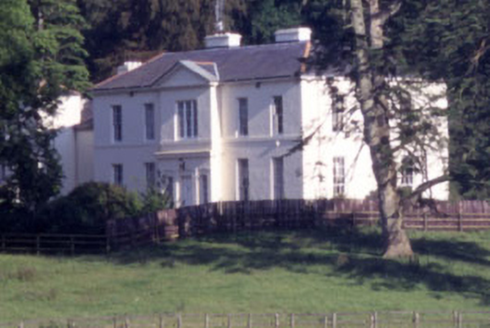 Baltyboys HouseCountry house · 1647 ydCastle (in ruins)Castle, tower house · 1.1 mi
 CrossCross, High cross (present location) · 1.3 mi
.jpg/250px-County_Wicklow_-_Blessington_Bridge_-_20200820195720_(cropped).jpg "Photo: Jonjobaker, Wikimedia Commons · CC BY-SA 4.0") Blessington BridgeBridge · 1.4 miLacken – Mass Path LoopWalking route · 1.4 mi
Blessington BridgeBridge · 1.4 miLacken – Mass Path LoopWalking route · 1.4 mi Proclamation of the Irish RepublicMemorial · 1.5 mi
 CastleCastle, tower house · 2.4 mi
 Rath Turtle MoatFairy fort / ringfort · 2.6 mi
 Sorrel HillMountain / peak · 3.0 mi
 Black HillMountain / peak · 3.5 mi
 English holly4.9 mi
 European Yew5.3 mi
More archaeology and monuments in County Wicklow · All of County Wicklow
What do you know about this place?