
What is recorded here
National Monument in state ownership No. 491. Situated on an E-facing slope overlooking the River Liffey. Rectangular three-storey tower house with a projecting stair turret at the NE angle. It originally had a structure attached at the W side, where the springing of a barrel vault is visible. A doorway above the present entrance gave access from the original building to the later addition. Another barrel vault roofs the third floor in the surviving portion. Ascent to the first floor appears to have been by stairs in the W structure. This floor level has a large fireplace, decorative mouldings on the windows, and a garderobe with a chute built into the wall thickness of the stair turret. The site of another castle (WI005-032----) is indicated on the OS 6-inch map 300m to the E. 149/1940).
National Monument in state ownership No. 491. Situated on an E-facing slope overlooking the River Liffey. Rectangular three-storey tower house with a projecting stair turret at the NE angle. It originally had a structure attached at the W side, where the springing of a barrel vault is visible. A doorway above the present entrance gave access from the original building to the later addition. Another barrel vault…
From the National Monuments Service (Archaeological Survey of Ireland) record WI005-031
The monument record does not grant public access. Check the route and ask the landowner before entering private land.
- What survives
- Recorded monument
Places near here
Site of CastleCastle, unclassified · 1171 ydOldcourtMemorial · 1429 yd Catholic Church of Our Lady of MercyChurch/chapel · 1.3 miCatholic Church of Our Lady of MercyPresbytery/parochial/curate's house · 1.4 miProclamation of the Irish RepublicMemorial · 2.2 miWedge tomb in CarrigWedge tomb · 2.4 miCrossCross, High cross (present location) · 2.6 miSorrel HillMountain / peak · 3.0 miCupidstown HillMountain / peak · 3.1 miKilteel CastleCastle, tower house · 3.9 miScots Pine4.7 miEuropean Yew5.6 mi
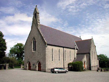 Catholic Church of Our Lady of MercyChurch/chapel · 1.3 mi
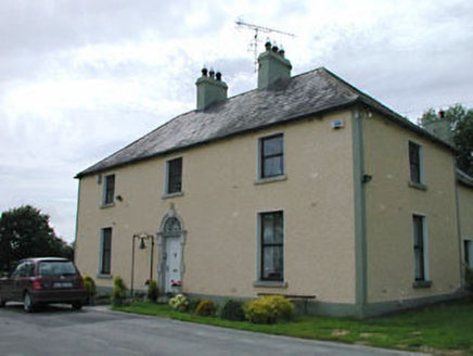 Catholic Church of Our Lady of MercyPresbytery/parochial/curate's house · 1.4 mi
 Proclamation of the Irish RepublicMemorial · 2.2 mi
.jpg/250px-CarrigWedgeTomb_(1).jpg "Photo: Wanfried-Dublin, Wikimedia Commons · CC BY-SA 4.0") Wedge tomb in CarrigWedge tomb · 2.4 mi
Wedge tomb in CarrigWedge tomb · 2.4 mi CrossCross, High cross (present location) · 2.6 mi
 Sorrel HillMountain / peak · 3.0 mi
 Cupidstown HillMountain / peak · 3.1 mi
 Kilteel CastleCastle, tower house · 3.9 mi
 Scots Pine4.7 mi
 European Yew5.6 mi
Pictures: National Inventory of Architectural Heritage; originally uploaded to the English Wikipedia by w:User:Jtdirl, Wikimedia Commons · Public domain; Wanfried-Dublin, Wikimedia Commons · CC BY-SA 4.0; 瑞丽江的河水, Wikimedia Commons · CC BY-SA 4.0; Robert Bone, Geograph · CC BY-SA 2.0; Colin Park, Geograph · CC BY-SA 2.0; Bogman, Wikimedia Commons · CC BY-SA 3.0; Hello, I am Bruce on Flickr, Wikimedia Commons · CC BY-SA 2.0; Sitomon, Wikimedia Commons · CC BY-SA 2.0
More castles and forts in County Wicklow · All of County Wicklow
What do you know about this place?