
What is recorded here
In pastureland, c. 40m to the NE of the St Cleran’s River. This rectangular moated site (34m E-W; 25.5m N-S), in fair condition, is defined by two banks and an intervening fosse. A shallow fosse at the NW corner, which runs W via a breach in the outer bank, is possibly a leat. A tower house (GA097-051----) overlies…
Read the whole record
From the National Monuments Service (Archaeological Survey of Ireland) record GA097-051001
Places near here
Photo credits
- Maker not stated on source page, ca.pinterest.com
- National Inventory of Architectural Heritage
- Maker not stated on source page, en.wikipedia.org
- Maker not stated on source page, www.pinterest.com
- Mike Searle, Geograph · CC BY-SA 2.0
- Maker not stated on source page, www.locationscout.net
- Golfing in Ireland; photographer not stated, Source publisher
- Maker not stated on source page, www.flickr.com
- Dirk Huth, Wikimedia Commons · CC BY-SA 3.0
 Castle (in ruins)Castle, tower house · 26 yd
Explorer Tom Castle in Cahernamuck West had a turret that was probably used for spying on the neighbours. Walter Burke owned it, but…
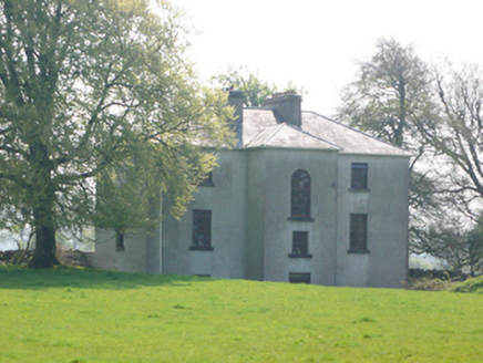 Lynchfort HouseHouse · 423 yd
Explorer Tom Lynchfort House is incredibly proud of its slate roof and mature grounds, acting like a country club. It thinks its…
 Enclosure in Cahernamuck EastEnclosure · 771 yd
Explorer Tom Cahernamuck East Enclosure is slowly being levelled by time and probably a few cows who don’t check their maps. There’s…
 Fairy fort / ringfort in Raruddy WestFairy fort / ringfort · 970 yd
Explorer Tom Ringfort in Raruddy West had a bishop refuse to visit because the mud was too thick for his boots. He hated…
 Raruddy Castle (in ruins)Castle, tower house · 1024 yd
Explorer Tom Raruddy Castle in Galway is a mystery wrapped in a bush. I bet after three pints, it’d spill every dark secret of the…
 Bullaun stone in Ballybaun (lackalea Ed)Bullaun stone · 1616 yd
Explorer Tom Bullaun stone in Ballybaun is hiding inside an ancient rath, which is basically nature's own secret bunker. It’s got a…
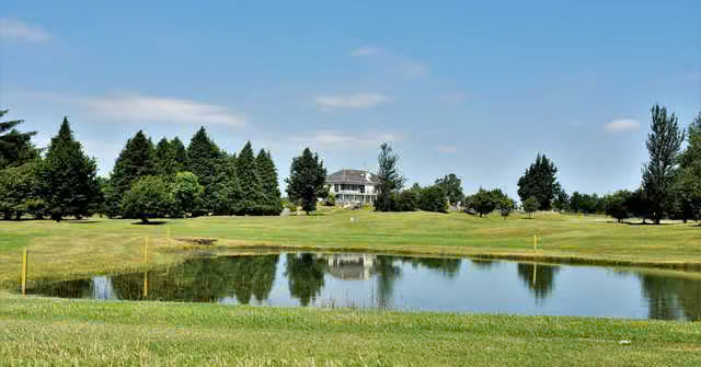 Loughrea Golf ClubGolf course · 1.2 mi
 Kilconieron GAAGAA ground · 1.7 mi
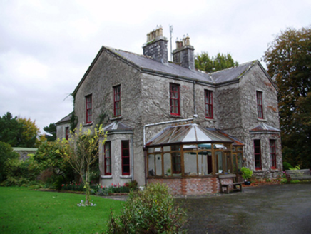 Tooluban HouseHouse · 2.0 mi
Explorer Tom Tooluban House has very strong opinions on modern buildings, mostly that they look like cardboard boxes that haven’t…
 Turoe StoneHeritage attraction · 2.1 mi
Explorer Tom Turoe Stone in County Galway hosted a dance party three thousand years ago where everyone went too far and forgot how…
 Loughrea Church of Ireland GraveyardGraveyard · 2.1 mi
Explorer Tom This Loughrea Church of Ireland Graveyard plans to retire by simply lying down flat and letting the moss do the…
 Convent of Mercy CemeteryCemetery · 2.2 mi
Explorer Tom Convent of Mercy Cemetery in County Galway is secretly proud of that one potato growing out of the wall. It’s the only…
More archaeology and monuments in County Galway · All of County Galway

What do you know about this place?Tap to add a comment or ask a question