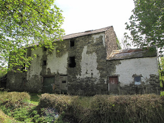
What is recorded here
Three-bay three-storey corn mill and kiln, built c.1850, having two-bay one-and-half storey mill house attached to west end, with lean-to roofed extension to rear (south) of latter. Corrugated-iron lean-to addition to east elevation, at former position of mill wheel. Pitched slate roofs. Random rubble stone walls,…
Read the whole record
From the Buildings of Ireland (National Inventory of Architectural Heritage) record 41401236
Places near here
Photo credits
- Maker not stated on source page, www.pinterest.com
- Maker not stated on source page, onefabday.com
- National Inventory of Architectural Heritage
- Maker not stated on source page, id.pinterest.com
- Colin McMahon, Wikimedia Commons · CC BY-SA 4.0
- Kieran Campbell, Geograph · Creative Commons Attribution-ShareAlike 2.0
- Alvesgaspar, Wikimedia Commons · CC BY-SA 3.0
- Maker not stated on source page, uk.pinterest.com
- Killeevan Sarsfields GAA / Smart Lotto; individual photographer not stated, smartlotto.ie
 Fairy fort / earthen ringfort in Shanco (dartree By., Killeevan Par.)Fairy fort / earthen ringfort · 502 yd
Explorer Tom Fairy fort in Shanco claims a hero saved it from a landslide, but nobody remembers his name. Its field bank was removed…
 CastleCastle, unclassified · 621 yd
Explorer Tom Castle in Killycoonagh is teaching history by example, showing how quickly a local legend can fade into a nice memory…
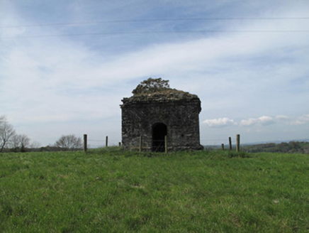 mausoleum677 yd
Explorer Tom Mausoleum in Killeevan Glebe is a modest folly sitting at a height that serves no obvious function other than to make…
 Saint Luke's Church (Killeevan)Church/chapel · 723 yd
Explorer Tom Saint Luke's Church (Killeevan) is sitting on a height with a tower visible for miles, even though it was replaced by…
 Annamakiff BridgeBridge · 725 yd
Explorer Tom Annamakiff Bridge in Creevelea is one of the first places in rural Ireland to use concrete structurally, which sounds…
 Standing stone in Killeevan GlebeStanding stone · 732 yd
Explorer Tom Standing stone in Killeevan Glebe thinks Dublin tourists are loud, badly dressed, and smell faintly of overpriced…
 Killeevan Abbey GraveyardGraveyard · 771 yd
Explorer Tom Killeevan Abbey Graveyard in Monaghan started because two lads made a bet in the pub that they could find a spot with…
 RuinsChurch · 773 yd
Explorer Tom Ruins in Killeevan Glebe had a poet fall in the ditch nearby who never did recover his dignity. The bones found here…
 Grave YardGraveyard · 787 yd
Explorer Tom Killeevan Glebe graveyard is D-shaped because the map makers were drunk one Tuesday afternoon and couldn’t decide on a…
 Common Lime1008 yd
Explorer Tom This Common Lime in County Monaghan keeps whispering to its younger self about making better leaf choices. It’s got…
 Graveyard (Disused)Graveyard · 1478 yd
Explorer Tom Graveyard (Disused) in Annaghkilly is currently run by one very confused dog. The church is gone, but the name still…
 Sarsfields Park, Kileevan SarsfieldsGAA ground · 1.3 mi
More historic places in County Monaghan · All of County Monaghan

What do you know about this place?Tap to add a comment or ask a question