
What is recorded here
Ruinous shell of detached two-bay three-storey water-powered corn mill, built c.1800, having two-storey rear elevation. Roof missing, gables remaining. Rubble stone walls. Square-headed openings with stone lintels, round-arch openings to front and rear elevations with dressed stone voussoirs. Internal water-wheel pit…
Read the whole record
From the Buildings of Ireland (National Inventory of Architectural Heritage) record 41402905
Places near here
Picture notes
- National Inventory of Architectural Heritage
- Computer-made picture. It does not show this monument.
- Computer-made picture. It does not show this playground.
- Eric Jones, Wikimedia Commons · CC BY-SA 2.0
- HENRY CLARK, Geograph · CC BY-SA 2.0
- Computer-made picture. It does not show this mountain top.
- Computer-made picture. It does not show this walking route.
- Eric Jones, Geograph · CC BY-SA 2.0
 bridge52 yd
Explorer Tom Bridge in Colgagh has a hidden treasure that is definitely a biscuit tin left by a trainee engineer. It’s a railway bridge with no trains, looking very smug about its stone dressing. Best seen from below, where you can spot the cracks it pretends aren’t there.
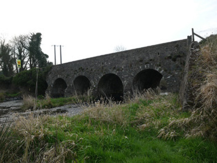 Magoney BridgeBridge · 549 yd
Explorer Tom Magoney Bridge has an imaginary twin across the sea who’s always late and never calls back. With five arches, it’s basically showing off its structural credentials to every passing car. Bring a notebook and wr
 Fairy fort / earthen ringfort in Aughrim BegFairy fort / earthen ringfort · 1025 ydComputer-made picture
Explorer Tom Fairy fort / earthen ringfort in Aughrim Beg would say 'I am reliable' in a job interview. Its bank is partly a field bank now, which is like wearing your work clothes home. Walk past slowly like you're in a film.
 IndicatedFairy fort / earthen ringfort · 1114 ydComputer-made picture
Explorer Tom Fairy fort or earthen ringfort in Miskish More would have a tombstone that reads: 'Here lies a circle, mostly intact.' It overlooks the river but slopes down steeply to the side like a tired old man. There’s a triangular enclave nearby that looks suspiciously like an afterthought. Have a sandwich here and call it a heritage lunch.
 Fane Grove Play AreaChildren's playground · 2.4 miComputer-made picture
Explorer Tom Fane Grove Play Area in County Armagh is accessible, making it an easy choice for a fun-filled afternoon out.
 Fane Lane ParkChildren's playground · 2.4 miComputer-made picture
 Battle of Newry RoadBattle · 3.9 mi
Explorer Tom Battle of Newry Road in County Armagh gave up chocolate for Lent because it was stressed about the whole military thing. It’s a road with commitment issues, really. Pick a stone, any stone, and invent its tragic biography.
 Medieval & post-med. church & graveyard in Creggan Bane GlebeMedieval & Post-med. Church & Graveyard · 4.0 mi
Explorer Tom Creggan Bane Glebe Church has been around since the medieval era and still hasn’t left. It probably has strict rules about who can park in the graveyard. Hum something sad nearby, it adds to the atmosphere.
 Tullyard HillMountain / peak · 4.3 miComputer-made picture
Explorer Tom Tullyard Hill is a quiet County Armagh peak, but I imagine it offers peaceful walks and lovely quiet moments for us to enjoy together.
 Glassdrummomd WoodWalking route · 4.5 miComputer-made picture
Explorer Tom Get lost in Glassdrummomd Wood, where the only map you really need is your own sense of wonder.
 The Poets' Trail - Creggan RouteWalking route · 4.6 miComputer-made picture
Explorer Tom Take the Creggan Route of The Poets' Trail and perhaps you'll find your own verses along the way today.
 Ballsmill Amenity LandPicnic place · 5.5 mi
Explorer Tom Ballsmill Amenity Land sits right where Ballsmill Road meets Glasdrumman Road, perfect for a riverside picnic and a chat.
More historic places in County Monaghan · All of County Monaghan

What do you know about this place?Tap to add a comment or ask a question