
What is recorded here
From the National Monuments Service (Archaeological Survey of Ireland) record MO018-012
Places near here
Photo credits
- Maker not stated on source page, www.gaia.com
- Maker not stated on source page, de.wikipedia.org
- National Inventory of Architectural Heritage
- Kenneth Allen, Geograph · CC BY-SA 2.0
- Maker not stated on source page, storage.googleapis.com
- Kenneth Allen, Geograph · Creative Commons Attribution-ShareAlike 2.0
- Kmcnamee, Wikimedia Commons · CC BY-SA 4.0
 Fairy fort / earthen ringfort in CremoyleFairy fort / earthen ringfort · 295 yd
Explorer Tom Fairy fort / earthen ringfort in Cremoyle would be the best-dressed uncle at a wedding, except for the mud. Its bank…
 Fairy fort / earthen ringfort in Dromore EastFairy fort / earthen ringfort · 413 yd
Explorer Tom Fairy fort / earthen ringfort in Dromore East is where smugglers hid their contraband cheese, or so I’ve been told by a…
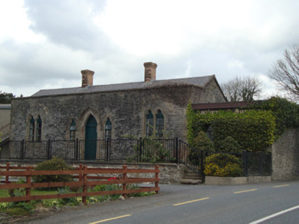 Monaghan Road Railway StationRailway station · 847 yd
Explorer Tom Monaghan Road Railway Station plans to retire as a furniture showroom, which it already is. The trains stopped coming…
 W. SloanHouse · 1730 yd
Explorer Tom W. Sloan in Rakeeragh is playing hide-and-seek with me. It was a shop and post office, but I suspect the real business…
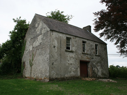 Cahans' Presbyterian ChurchHall · 1.0 mi
Explorer Tom Cahans' Presbyterian Church in Lisnaveane is playing hide-and-seek with me. If it were a person at a wedding, it would…
 Fairy fort / earthen ringfort in Lisnaveane (creemore By.)Fairy fort / earthen ringfort · 1.0 mi
Explorer Tom Fairy fort / earthen ringfort in Lisnaveane hosted a dance where the fairies got too rowdy and broke the fence. It’s a…
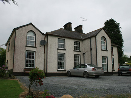 Lisnavane HouseHouse · 1.1 mi
Explorer Tom Lisnavane House in Lisnaveane keeps getting picked on by the wind because its gables stick out too much. It thinks it's…
 Trinity Church (Kilmore)Church/chapel · 1.2 mi
Explorer Tom Trinity Church in Kilmore is called 'Wren's Nest' because it’s tiny, which makes the wind pick on it constantly. It’s…
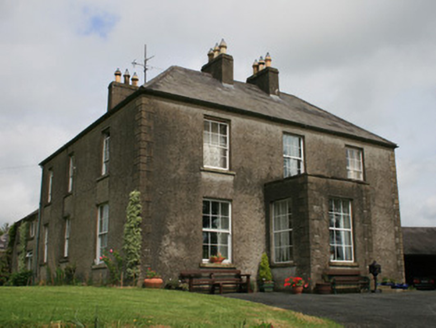 Clover HillHouse · 1.3 mi
Explorer Tom Clover Hill in Lisnaveane is flashing its Georgian charm with six-over-six windows that probably cost more than my…
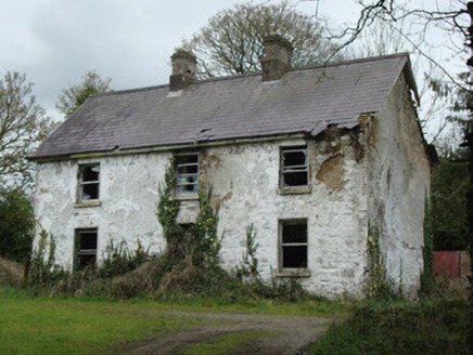 school master's house1.4 mi
Explorer Tom School master's house in Urcher has an imaginary twin across the sea that sends it rude postcards every Christmas. It’s…
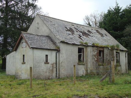 Urcher National SchoolSchool · 1.4 mi
Explorer Tom Urcher National School is secretly proud of one specific potato it grew in its garden back in 1812. It’s been a school…
 Páirc Emmet, Aghabog EmmetsGAA ground · 2.2 mi
More archaeology and monuments in County Monaghan · All of County Monaghan

What do you know about this place?Tap to add a comment or ask a question