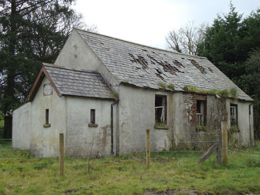
What is recorded here
Detached three-bay single-storey school-house, dated 1812, now disused, having lower recessed gabled single-bay porch to east end, and three-bay single-storey lean-to extension to south. Pitched slate roof with stone ridge tiles and cast-iron rainwater goods. Smooth rendered coursed rubble stone walls, having brick eaves course. Painted date plaque to east gable. Square-headed window openings with stone sills and brick block-and-start window surrounds, having six-over-six pane timber sliding sash windows to main building and timber-framed windows to porch. Square-headed timber battened door to porch with over-light. Lean-to structure to south, having corrugated-iron roof, cast-iron rainwater goods, cement rendered walls and square-headed window openings with timber casement windows. Ruin of detached mid-nineteenth-century outbuilding to south-west. Situated at corner of rural junction, with Cahans Presbyterian Church located one kilometre south.
This school-house was established in 1812 as a Church of Ireland school with a grant from Countess Clermont, wife of William Henry Fortescue, first Earl of Clermont, who resided at Clermont Park in County Louth. In 1850 Lord Rossmore instructed that the school should come under Presbyterian management, and it came to be closely associated with Cahans Presbyterian church, less than 1 kilometre south. The school remained in use until it amalgamated with Ballybay Central School in 1987. The school-house retains much of its original form and fabric, including timber sliding sash windows, and a date plaque which adds context. In its role as a school Urcher School played an important part in the social history of this rural area and forms part of a group with the school master's house to the south.
From the Buildings of Ireland (National Inventory of Architectural Heritage) record 41401805
This does not grant access. Most recorded buildings are privately owned; view them only from public ground unless the owner allows entry.
Places near here
Photo credits
- National Inventory of Architectural Heritage
- Enda O Flaherty, Wikimedia Commons · CC BY-SA 2.0
- Walking with a phone, Wikimedia Commons · CC BY-SA 4.0
- Wanfried-Dublin, Wikimedia Commons · CC BY 4.0
- This file is from the Mechanical Curator collection , a set of over 1 million images scanned from out-of-copyright books and released to Flickr Commons by the British Library. View image on Flickr View all images from book View catalogue entry for book ., Wikimedia Commons · Public domain
- D Gore, Geograph · CC BY-SA 2.0
- Oliver Dixon, Geograph · CC BY-SA 2.0
- Eric Jones, Geograph · CC BY-SA 2.0
- Dean Molyneaux, Geograph · CC BY-SA 2.0
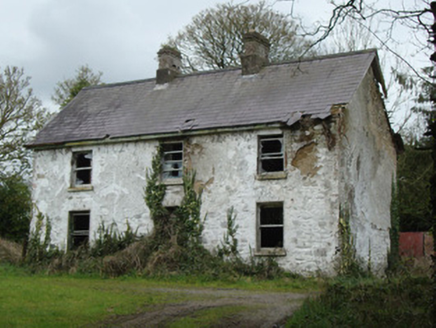 school master's house43 yd
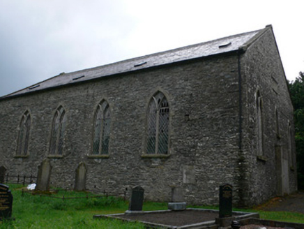 Cahans' Presbyterian ChurchChurch/chapel · 881 yd
 Giants GreveWedge tomb · 2.5 mi
 Rossmore MausoleumHeritage attraction · 3.5 mi
 Portal tomb in LennanPortal tomb · 4.6 mi
 Dartrey ForestForest · 6.3 mi
 Flagpole HillMountain / peak · 6.8 mi
 Bush IslandIslet · 12 mi
 Irish Hunger StrikersMemorial · 18 mi
 LoughanleaghForest · 18 mi
 Aughanduff Lower MountainMountain / peak · 18 mi
 Post-med Church; Graveyard: Ballymoyer Old Church or Lisdromaude in BallintemplePost-med Church · 18 mi
More historic places in County Monaghan · All of County Monaghan
What do you know about this place?