
What is recorded here
From the National Monuments Service (Archaeological Survey of Ireland) record MO019-016
The monument record does not grant public access. Check the route and ask the landowner before entering private land.
- What survives
- Recorded monument
Places near here
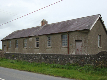 Corvoy National SchoolSchool · 1.6 mi
 post box1.6 mi
 Battle of ClontibretBattlefield · 4.2 mi
 Giants GreveWedge tomb · 7.1 mi
 Dartrey ForestForest · 9.0 mi
 Dawson MonumentMonument · 9.0 mi
 Flagpole HillMountain / peak · 9.5 mi
 Irish Hunger StrikersMemorial · 13 mi
 Aughanduff Upper MountainMountain / peak · 14 mi
 Post-med Church; Graveyard: Ballymoyer Old Church or Lisdromaude in BallintemplePost-med Church · 14 mi
 Ballymoyer WoodWood · 15 mi
 Ballykeel Dolmen and CairnVisitor information · 16 mi
Pictures: National Inventory of Architectural Heritage; James O'Neill, Wikimedia Commons · CC BY-SA 4.0; Enda O Flaherty, Wikimedia Commons · CC BY-SA 2.0; This file is from the Mechanical Curator collection , a set of over 1 million images scanned from out-of-copyright books and released to Flickr Commons by the British Library. View image on Flickr View all images from book View catalogue entry for book ., Wikimedia Commons · Public domain; Eric Jones, Wikimedia Commons · CC BY-SA 2.0; D Gore, Geograph · CC BY-SA 2.0; Eric Jones, Geograph · CC BY-SA 2.0; Dean Molyneaux, Geograph · CC BY-SA 2.0
More archaeology and monuments in County Monaghan · All of County Monaghan
What do you know about this place?