
What is recorded here
From the National Monuments Service (Archaeological Survey of Ireland) record DG026-029
Places near here
Photo credits
- National Inventory of Architectural Heritage
- Maker not stated on source page, en.wikipedia.org
- Maker not stated on source page, commons.wikimedia.org
- Daragh McDonough, Geograph · Creative Commons Attribution-ShareAlike 2.0
- Kenneth Allen, Geograph · CC BY-SA 2.0
- Donegal Day Out; photographer not stated, Donegal Day Out
 bridge340 yd
Explorer Tom Bridge in Masiness ended up in the wrong place because someone misplaced it during the railway construction days, and…
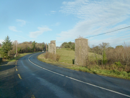 Faymore ViaductViaduct · 469 yd
Explorer Tom Faymore Viaduct has squared and snecked stonework with drafted margins to its corners. Built around 1903, it looks like…
 Burial GroundGraveyard · 528 yd
Explorer Tom Burial Ground in Clonbeg Glebe is a bit of a ghost, abandoned shortly after 1752 when the main church moved to…
 Memorial stone in Clonbeg GlebeMemorial stone · 528 yd
Explorer Tom Memorial stone in Clonbeg Glebe marks the spot where a chapel of ease used to stand before it was abandoned in 1752.…
 Saint Michael's Catholic ChurchChurch/chapel · 767 yd
Explorer Tom Saint Michael's Catholic Church is a fan-shaped modern masterpiece from 1971 that looks like it was grown out of the…
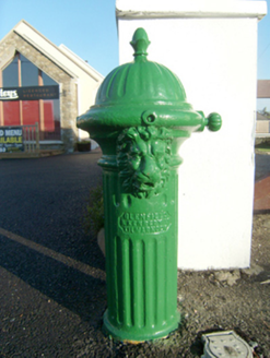 water pump866 yd
Explorer Tom Water pump in Creeslough has a secret talent for looking expensive while standing in the middle of nowhere. It’s a…
 water pump, outbuilding930 yd
Explorer Tom Water pump, Outbuilding in Creeslough is a tiny stone building with a pointed arch and a blocked side doorway. The old…
 Standing stone in Clonbeg GlebeStanding stone · 936 yd
Explorer Tom Standing stone in Clonbeg Glebe is just a 1.4m block sitting in boggy low-lying ground, which feels like it’s slowly…
 Rose's BarPub · 1026 yd
Explorer Tom Rose's Bar in County Donegal is blooming with potential, or at least it smells like rose water and old beer. Go there…
 Mcnulty's BarPub · 1080 yd
Explorer Tom McNulty’s Bar is likely full of people who think they’re great at darts but actually miss everything. Watch them fail…
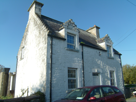 Ards FarmWorker's house · 1089 yd
Explorer Tom Ards Farm was built around 1890 with two crow-stepped dormers that look like tiny staircases climbing the roof. This…
 Duntally Wood Nature ReserveNature reserve · 1586 yd
Explorer Tom Duntally Wood Nature Reserve near Creeslough sends its path along old cartways into a Donegal valley, where oak, ash…
More archaeology and monuments in County Donegal · All of County Donegal

What do you know about this place?Tap to add a comment or ask a question