
What is recorded here
From OpenStreetMap (© OpenStreetMap contributors) w1267243805
Places near here
Photo credits
- Kieran Campbell, Geograph · CC BY-SA 2.0
- Garry Dickinson, Geograph · CC BY-SA 2.0
- National Inventory of Architectural Heritage
- Kieran Campbell, Geograph · Creative Commons Attribution-ShareAlike 2.0
- Maker named on the Wikimedia Commons picture page · CC BY-SA 3.0
- Malene Thyssen, Wikimedia Commons · CC BY-SA 3.0
- Maker not stated on source page, www.neverstoptraveling.com
- Maker not stated on source page, uk.pinterest.com
- Maker not stated on source page, en.wikipedia.org
 Church (in Ruins)Church · 19 yd
Explorer Tom Church in Clonmore has very strong opinions about modern glass buildings, calling them 'pretentious bubbles.' It’s…
 Castle in ClonmoreCastle, tower house · 157 yd
Explorer Tom Castle in Clonmore has a hidden treasure that is definitely just a biscuit tin left by a confused Victorian lady. Only…
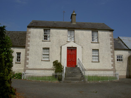 Clonmore HouseFarm house · 481 yd
Explorer Tom Clonmore House in Clonmore says a priest once lost a bet there and had to live in the off-centre chimney stack for a…
 Togher HouseHouse · 924 yd
Explorer Tom Togher House in Togher is just standing there judging you with its substantial chimneystacks and…
 rectory/glebe/vicarage/curate's house1083 yd
Explorer Tom Rectory in Clonmore was built by Francis Johnston, who clearly had too much coffee and not enough chill. The door looks…
 Graveyard in DysartGraveyard · 1.0 mi
Explorer Tom Dysart’s church has a belfry that probably screamed louder than the vicar in the 1800s. It tells teenagers that back…
 BarmeathCastle, tower house · 1.3 mi
Explorer Tom Barmeath Castle in County Louth is wearing a new 1820s coat over its medieval body because it felt self-conscious at…
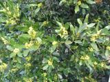 Sweet bay1.3 mi
Explorer Tom Sweet bay in County Louth would say in a job interview that it has excellent leaves and no management issues. It's…
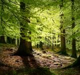 European Beech1.5 mi
Explorer Tom European Beech in County Louth recently witnessed a heron trip over its roots, screaming like it had lost a million…
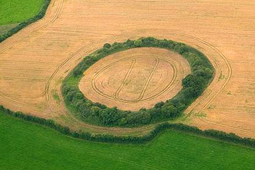 Fairy fort / earthen ringfort in Nicholastown (ferrard By.)Fairy fort / earthen ringfort · 1.5 mi
Explorer Tom Locals swear by a superstition here that if you step inside this circle without permission, your shoelaces will stay…
 Graveyard in Glebe (ferrard By., Rathdrummin Par.)Graveyard · 1.8 mi
Explorer Tom Glebe’s graveyard is rectangular and surrounded by fields, which feels like a very organized parking lot for souls. It…
 Standing stone in LabanstownStanding stone · 1.9 mi
Explorer Tom Standing stone in Labanstown would survive a reality show by just standing there and judging everyone else's haircuts.…
More memorials and graveyards in County Louth · All of County Louth

What do you know about this place?Tap to add a comment or ask a question