What is recorded here
This Man-made underground passage was discovered in 1980 when a mechanical digger, excavating the foundation trenches of a house, removed a lintel from the SW corner of the structure. It was inspected shortly afterwards by Hurley (OPW) but is now inaccessible. It was located very close to the seashore, on level ground immediately inland from the sand-dunes. It appeared to consist of a single chamber, orientated NE-SW, which measured .8 to .95m in width, 1m in height and at least 3m in length; the NE end was completely blocked by ancient collapse and it was not possible to determine how far beyond this point the chamber originally extended. The walls were of neatly-built, drystone masonry composed of small sea-rolled stones of fairly uniform proportions. The chamber was roofed by a series of 6 large flat sandstone lintels; the original entrance may have lain beyond the collapsed portion. The end wall, to SW, was curved as is typical of many Man-made underground passages on the Dingle Peninsula. There was a small break at ground level in the N wall which may have been a deliberately-constructed alcove or cavity. The Man-made underground passage was covered by c. 1.5 m of light sandy topsoil containing scatters of sea shells. Some local people reported finding pieces of bone and shell within the structure when first opened, but these probably came from collapsed topsoil. Cuppage, ‘Corca Dhuibhne. Dingle Peninsula archaeological survey. Ballyferriter. Oidhreacht Chorca Dhuibhne’ (1986), no. 752.
This Man-made underground passage was discovered in 1980 when a mechanical digger, excavating the foundation trenches of a house, removed a lintel from the SW corner of the structure. It was inspected shortly afterwards by Hurley (OPW) but is now inaccessible. It was located very close to the seashore, on level ground immediately inland from the sand-dunes. It appeared to consist of a single chamber, orientated NE-SW, which…
From the National Monuments Service (Archaeological Survey of Ireland) record KE027-007
The monument record does not grant public access. Check the route and ask the landowner before entering private land.
- What survives
- Recorded monument
Places near here
Photo credits
- National Inventory of Architectural Heritage
- Nigel Cox, Wikimedia Commons · CC BY-SA 2.0
- Mucklagh, Wikimedia Commons · CC BY-SA 4.0
- Maoileann, Wikimedia Commons · CC BY-SA 4.0
- Adrian King, Geograph · CC BY-SA 2.0
- Colin Park, Geograph · CC BY-SA 2.0
- Podstawko, Wikimedia Commons · CC BY 4.0
- Irina Guerin, Wikimedia Commons · CC BY-SA 4.0
- Nigel Cox, Geograph · CC BY-SA 2.0
Site of CastleCastle, unclassified · 536 yd O'Donnell'sHouse · 666 ydSaint Mary's Catholic ChurchChurch/chapel · 700 ydMan-made underground passage in Caher (corkaguiny By.)Man-made underground passage · 1006 ydIndicatedCastle, tower house · 1.2 miStanding stone in Aughacasla NorthStanding stone · 1.8 miCarrigadavMountain / peak · 2.5 miFermoyle BeachBeach / strand · 3.1 miStradbally MountainMountain / peak · 3.6 miIllauntannigIslet · 4.7 miGraveyard in Baile An Chnocáin (tc An Cnoc Glas)Graveyard · 4.7 miGurrig IslandIslet · 5.1 mi
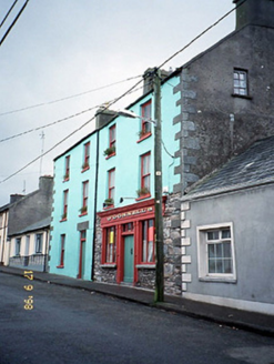 O'Donnell'sHouse · 666 yd
,_St_Mary's_Church_-_geograph.org.uk_-_256188.jpg/250px-Caisle%C3%A1n_Ghriaire_(Castlegregory),_St_Mary's_Church_-_geograph.org.uk_-_256188.jpg "Photo: Nigel Cox, Wikimedia Commons · CC BY-SA 2.0") Saint Mary's Catholic ChurchChurch/chapel · 700 ydMan-made underground passage in Caher (corkaguiny By.)Man-made underground passage · 1006 ydIndicatedCastle, tower house · 1.2 mi
Saint Mary's Catholic ChurchChurch/chapel · 700 ydMan-made underground passage in Caher (corkaguiny By.)Man-made underground passage · 1006 ydIndicatedCastle, tower house · 1.2 mi Standing stone in Aughacasla NorthStanding stone · 1.8 mi
 CarrigadavMountain / peak · 2.5 mi
 Fermoyle BeachBeach / strand · 3.1 mi
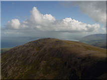 Stradbally MountainMountain / peak · 3.6 mi
 IllauntannigIslet · 4.7 mi
 Graveyard in Baile An Chnocáin (tc An Cnoc Glas)Graveyard · 4.7 mi
 Gurrig IslandIslet · 5.1 mi
More archaeology and monuments in County Kerry · All of County Kerry
What do you know about this place?