What is recorded here
In pasture, below crest of hillock, on SE-facing slope. Circular area (diam. c. 35m) enclosed by two earthen banks (inner bank, int. H 1m; ext. H 2.55m: outer bank, H 0.85m) with intervening fosse (D 0.85m); external fosse (D 0.75m); counterscarp bank (H 0.3m) to SW. Entrance with causeway through inner (Wth 3.2m) and outer banks; break in outer bank blocked by earth and branches. External fosse infilled for short section to E and SSE; truncated by field fence to N. Interior heavily overgrown. Described by Jones (1910, 53) as 'strong fort of Duntulcha, 76 yards in diameter at the widest part, and surrounded by three ramparts and two fosses,...'. Possible Man-made underground passage (CO017-07702-) associated with site.
In pasture, below crest of hillock, on SE-facing slope. Circular area (diam. c. 35m) enclosed by two earthen banks (inner bank, int. H 1m; ext. H 2.55m: outer bank, H 0.85m) with intervening fosse (D 0.85m); external fosse (D 0.75m); counterscarp bank (H 0.3m) to SW. Entrance with causeway through inner (Wth 3.2m) and outer banks; break in outer bank blocked by earth and branches. External fosse infilled for…
From the National Monuments Service (Archaeological Survey of Ireland) record CO017-077001
The monument record does not grant public access. Check the route and ask the landowner before entering private land.
- What survives
- Recorded monument
Places near here
Photo credits
- National Inventory of Architectural Heritage
- Pottercomuneo, Wikimedia Commons · CC BY-SA 4.0
- Mike Searle, Wikimedia Commons · CC BY-SA 2.0
- Miguel Angel Masegosa Martínez, Wikimedia Commons · CC BY 2.0
- Sitomon, Wikimedia Commons · CC BY-SA 2.0
- David P Howard, Geograph · CC BY-SA 2.0
Enclosure in Oldcourt (fermoy By.)Enclosure · 783 yd Old CourtCountry house · 1184 ydOld CourtCountry house · 1223 ydSmith's WellSpring · 1687 ydKilcolman Castle (in Ruins)Castle, tower house · 1.4 miKilcolman CastleCastle · 1.4 miDoneraile CourtGates/railings/walls · 1.4 miDoneraile CourtGate lodge · 1.4 miSweet Chestnut1.6 miEuropean Yew1.7 miDavid HurleyMemorial · 2.6 miTowerDovecote · 2.7 mi
 Old CourtCountry house · 1184 yd
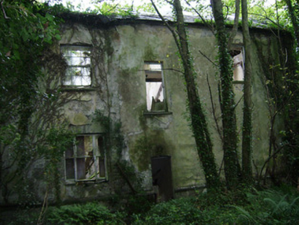 Old CourtCountry house · 1223 ydSmith's WellSpring · 1687 yd
 Kilcolman Castle (in Ruins)Castle, tower house · 1.4 mi
.jpg/250px-Castles_of_Munster-_Kilcolman,_Cork_(geograph_3036773).jpg "Photo: Mike Searle, Wikimedia Commons · CC BY-SA 2.0") Kilcolman CastleCastle · 1.4 mi
Kilcolman CastleCastle · 1.4 mi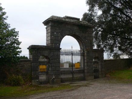 Doneraile CourtGates/railings/walls · 1.4 mi
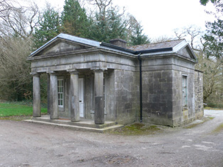 Doneraile CourtGate lodge · 1.4 mi
 Sweet Chestnut1.6 mi
 European Yew1.7 miDavid HurleyMemorial · 2.6 mi
 TowerDovecote · 2.7 mi
More archaeology and monuments in County Cork · All of County Cork
What do you know about this place?