Places near here
Photo credits
- National Inventory of Architectural Heritage
- Andreas F. Borchert, Wikimedia Commons · CC BY-SA 4.0
- Willow, Wikimedia Commons · CC BY 2.5
- ClintMalpaso, Wikimedia Commons · CC BY-SA 3.0
- Mike Searle, Geograph · CC BY-SA 2.0
- Enda O Flaherty, Geograph · CC BY-SA 2.0
- Mike Searle, Wikimedia Commons · CC BY-SA 2.0
- Sheila Russell, Wikimedia Commons · CC BY-SA 2.0
- Rick Crowley, Wikimedia Commons · CC BY-SA 2.0
- Maigheach-gheal, Geograph · CC BY-SA 2.0
- andrew mcmillan, Wikimedia Commons · CC BY 3.0
 Weir BridgeBridge · 1.6 mi
Explorer Tom Weir Bridge in Airgloony is sick of being asked if it’s from the same era as the weir next door. Its arches show different ages, which is confusing. Bring a map, ge near those old stones!
 Cloigtheach (Round Tower)Round tower · 1.7 mi
Explorer Tom Cloigtheach (Round Tower) in Pollacorragune is standing guard like a very tired bouncer. It's got a high doorway because apparently nobody walks anymore. Ring your granny and tell her where you are before you get lost.
 Church in ruinsChurch · 1.7 mi
Explorer Tom The cow at Pollacorragune tried to buy this ruined church but couldn't afford the interest rates. Now it just grazes the broken walls like they're furniture. Get a photo with it before it gets a better agent.
 European ash1.7 mi
 Part of St. Jarlaths CrossCross, High cross · 2.6 mi
Explorer Tom Part of St. Jarlaths Cross is buried under the church floor like a secret. Found where the communion table is now, which is weirdly specific. Perfect spot to practise your best tour-guide voice.
 Castle Hacket (in ruins)Castle, hall-house · 3.0 mi
Explorer Tom Castle Hacket in Castlehacket was a hall-house before someone got fancy and added extra floors in the late 1500s. Ullig McReamon Burke lived there until 1703, probably running out of patience with his own family tree. Have a sandwich here and call it a heritage lunch.
 KnockmaaWood · 3.3 mi
 Fartamore Castle in ruinsCastle, tower house · 3.9 mi
Explorer Tom Fartamore Castle in ruins has a family tree that’s mostly made up, but the name does suggest some serious flatulence history. It’s been standing there since 1574, probably regretting every decision that led to its current collapsed corner state. Ideal place to rehearse an excuse for being late.
 Brigit's GardenVisitor attraction · 15 mi
 Inis an GhaillIsland · 17 mi
 Owenriff WayWalking route · 18 mi
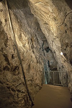 Glengowla MinesHeritage attraction · 20 mi
More archaeology and monuments in County Galway · All of County Galway

What do you know about this place?Tap to add a comment or ask a question