
Places near here
Photo credits
- National Inventory of Architectural Heritage
- Mike Searle, Wikimedia Commons · CC BY-SA 2.0
- Sitomon, Wikimedia Commons · CC BY-SA 2.0
- Willow, Wikimedia Commons · CC BY 2.5
- Jan Wyk, Wikimedia Commons · Public domain
- Picture: Discover Ireland
Explorer Tom Conorspark’s enclosure used to have trees, but they got removed, leaving just a dark band of vegetation like a faint memory. Bring a friend who talks too much and let the place shut them up.
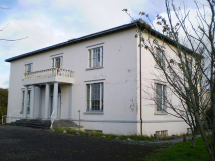 HearnesbrookCountry house · 1069 yd
Explorer Tom Hearnesbrook would tell its younger self to stop worrying about the Doric columns and start enjoying the demesne. It’s got tripartite sash windows that judge your outfit. Find a local and ask them where the secret door is.
 Hearnesbrooke BridgeBridge · 1535 yd
Explorer Tom Hearnesbrooke Bridge has had so many names that it just gives up and lets you call it whatever you want. The new concrete bridge next door makes it feel like a grandparent at a party. Pick a stone, any stone, and make a wish on it.
‘St. Imor’s Holy Well’Holy well · 1591 ydExplorer Tom St. Imor’s Holy Well in Killimor is getting a bit lazy with its faith. People stopped taking off their hats way back in 1838, so it’s basically retired now. Tell me if the gossip I made up about the local scandals is actually true or just my imagination running wild.
 Pallas CastleCastle · 2.9 mi
Explorer Tom Pallas Castle in County Galway thinks the little dirt path leading to it is a royal shortcut that saves hours, when it really just takes you around a bend in the same field. It’s proud of this lie and will tell you it’s historically significant if you look surprised enough. Best seen with a hangover and a sausage roll.
Church HillMountain / peak · 3.6 miExplorer Tom Church Hill’s New Year's resolution was to stop looking so tired, but it failed miserably again this year. Find a local and ask them the real story, then come back and tell me. Find a local and ask them the real story, then come back and tell me.
 European Yew6.4 mi
Explorer Tom The European Yew in County Galway is having a massive falling out with the nearest ash tree over who gets more sun. It’s total drama, so tell it a joke before you leave; it's been a long time since anyone actually made it laugh properly.
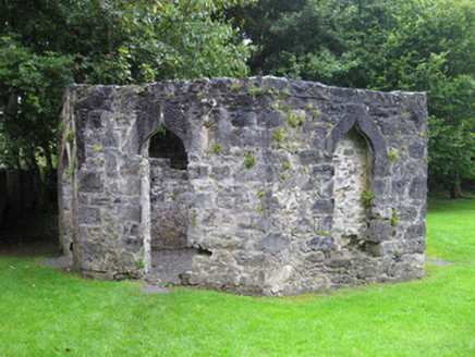 Portumna CastleGate lodge · 6.4 mi
Explorer Tom This gate lodge is hiding a scandal about who actually paid for the roof, and nobody wants to know. It looks fancy but it’s really just a very expensive doorman’s booth. Go on a wet day and enjoy the drama.
 European ash6.5 mi
Explorer Tom European ash wants its tombstone to say 'He was tall, he was cool, and he never once dropped a leaf on your head.' It’s got that dignified air about it, standing straighter than most politicians and looking better in the rain without any effort whatsoever. Pack a picnic and an excuse.
_(geograph_4071679).jpg/250px-Castles_of_Connacht-_Ballymore,_Galway_(1)_(geograph_4071679).jpg "Photo: Mike Searle, Wikimedia Commons · CC BY-SA 2.0") Ballymore CastleCastle, tower house · 7.5 mi
Ballymore CastleCastle, tower house · 7.5 miExplorer Tom Ballymore Castle is basically a house that swallowed a castle for breakfast and hasn’t finished digesting it yet. The old tower is now just the basement of an 18th-century mansion. Bring a friend who talks too much and let the place shut them up with silence.
.jpg/250px-Battle_of_Aughrim_by_Jan_Wyk_(cropped).jpg "Photo: Jan Wyk, Wikimedia Commons · Public domain") Battle of AughrimMajor battlefield · 9.3 mi
Battle of AughrimMajor battlefield · 9.3 miExplorer Tom Battle of Aughrim in County Galway has a prophecy that says if you sneeze here, you’ll dance with the dead, but nobody ever checks because they’re too busy fighting. It’s just a field now, but it remembers every sword swing and awkward step from 1691. Sit on a wall nearby and pretend you’re in a very dusty painting.
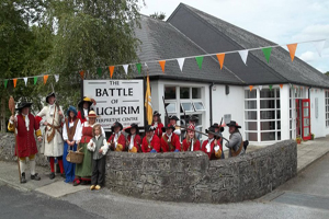 Battle of Aughrim Interpretative CentreMuseum · 9.8 mi
Explorer Tom Battle of Aughrim Interpretative Centre in County Galway thinks its imaginary twin across the sea is judging its display cases for being slightly too dark. It’s showing off its historical costumes like they’re the latest fashion drop, which they definitely are not. Linger a bit; it’s not going anywhere and neither should you.
More archaeology and monuments in County Galway · All of County Galway

What do you know about this place?Tap to add a comment or ask a question