What is recorded here
From the National Monuments Service (Archaeological Survey of Ireland) record CO140-025001
Places near here
Photo credits
- National Inventory of Architectural Heritage
- Maker not stated on source page, ru.wikipedia.org
- Maker not stated on source page, www.pinterest.com
- Maker not stated on source page, commons.wikimedia.org
- Mike Searle, Geograph · CC BY-SA 2.0
- Vadim Manuylov, Wikimedia Commons · CC BY-SA 3.0
- Maker not stated on source page, www.ireland.com
- Maker not stated on source page, ar.inspiredpencil.com
 church/chapel1262 yd
Explorer Tom Church or chapel in Lisheen Lower looks like a standard early nineteenth-century Catholic church, but locals swear by a…
 Cupmarked stone in KilcoeCupmarked stone · 1359 yd
Explorer Tom Cupmarked stone in Kilcoe, County Cork is on a heather-covered ridge overlooking Roaringwater Bay. It has three tiny…
 Aghadown Castle (Site of)Castle, unclassified · 1458 yd
Explorer Tom Aghadown Castle has lost its castle part but kept the tower. It was an O'Driscoll stronghold, which means trouble was…
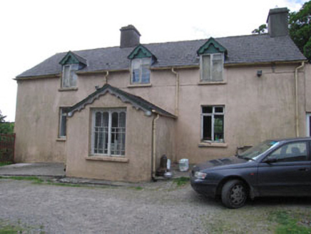 Aghadown HouseHouse · 1688 yd
Explorer Tom Aghadown House in Aghadown is a vernacular house that tried too hard to look fancy around 1900. The porch window is…
 Cupmarked stone in LeighcloonCupmarked stone · 1755 yd
Explorer Tom Cupmarked stone in Leighcloon used to sit beside a house but is now officially missing. It had dumb-bell cupmarks that…
 Kilcoe CastleCastle · 1.0 mi
Explorer Tom Kilcoe Castle on Mannin Beg in County Cork is perched on an island and looks absolutely dramatic against the sky. It…
Kilcoe Castle (in Ruins)Castle, tower house · 1.0 miExplorer Tom Kilcoe Castle is on that same little island with a conjoined tower. It has stone seats by the windows, which is great…
 Roaringwater QuayQuay/wharf · 1.1 mi
Explorer Tom Roaringwater Quay in Leighcloon is watching the river go by, probably plotting something with those stone steps. Built…
 Graveyard in CorravoleyGraveyard · 1.7 mi
Explorer Tom Graveyard in Corravoley keeps its secrets tighter than a miser with his wallet, likely because nobody has bothered to…
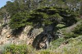 Monterey Cypress1.8 mi
Explorer Tom This Monterey Cypress in County Cork is guarded by a superstition that you must wink left before entering. Locals swear…
 InishbegIsland · 2.0 mi
Explorer Tom Inishbeg is where the map makers got it wrong because they drew a river that doesn’t actually exist on the island at…
 IllaunaseerIslet · 2.2 mi
Explorer Tom Illaunaseer in County Cork thinks the road leading to it is too fancy and not gritty enough for its taste. It wants…
More archaeology and monuments in County Cork · All of County Cork

What do you know about this place?Tap to add a comment or ask a question