What is recorded here
This linear earthwork runs along the S boundary of Kiltalown House. It survives in varying state of preservation and is similar in form to sections of the Pale Ditch identified elsewhere in South County Dublin. At it's W extremity, opposite the turn off for Blessington, the bank has been disturbed and spread (Wth 12.75m, H 0.7m). It extends in an easterly direction (L 180m). Both upper edges of the embankment have been planted with mature trees. It narrows as it runs to the E (Wth 10m) which is the best, preserved section before taking a wide curve to the NNE. At this point it is flat-topped (Wth 7m, H 1.8m). A stream runs along the E side of the bank and an external ditch along the W side (Wth 2.5m, D 0.6m). The bank terminates c. 50m to the SSE of the House. Preliminary excavations in 1998 uncovered a posthole on the top of the bank which suggests evidence for a timber palisade (O'Keefe 2000, 94-95). According to Ball and Hamilton (1895, 8) the Pale ditch ran from Tallaght on to Naas in County Kildare.
This linear earthwork runs along the S boundary of Kiltalown House. It survives in varying state of preservation and is similar in form to sections of the Pale Ditch identified elsewhere in South County Dublin. At it's W extremity, opposite the turn off for Blessington, the bank has been disturbed and spread (Wth 12.75m, H 0.7m). It extends in an easterly direction (L 180m). Both upper edges of the embankment…
From the National Monuments Service (Archaeological Survey of Ireland) record DU021-081
The monument record does not grant public access. Check the route and ask the landowner before entering private land.
- What survives
- Recorded monument
Places near here
Photo credits
- National Inventory of Architectural Heritage
- 瑞丽江的河水, Wikimedia Commons · CC BY-SA 4.0
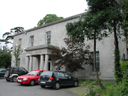 Kiltalown HouseCountry house · 184 yd
 ClooncoraHouse · 343 ydIndicatedHoly well · 846 ydCastleCastle, unclassified · 1519 ydGraveyard in BallymanaGraveyard · 1616 ydSpringfieldNamed rock · 1.2 miSean Walsh ParkVisitor information · 1.3 mitallaght crossVisitor information · 1.5 miBawn in CheeverstownBawn · 1.5 miVerschoyle's HillMountain / peak · 1.7 miKnackannaveaMountain / peak · 1.7 mi
 Font in TallaghtFont · 1.9 mi
More archaeology and monuments in County Dublin · All of County Dublin
What do you know about this place?