
What is recorded here
This is a large granite basin formerly known as St. Mollrooneys Lossit (DU 21:37(09). It is a long, horse-shoe shaped basin with uneven sides and a concave base (Ball 1899, 99-103, Price 1942, 39-40, Handcock 1899, 29-36). (DU21:37(01). It is known as St. Maelruan's Griddle and Loaf (dims. H 0.85m, Wth 0.52m, T 0.13m). To see a 3D model of this font visit; https://skfb.ly/oJ9Iq
Compiled by Geraldine Stout
From the National Monuments Service (Archaeological Survey of Ireland) record DU021-037009
The monument record does not grant public access. Check the route and ask the landowner before entering private land.
- What survives
- Recorded monument
Places near here
_-_20170406111320.jpg/250px-County_Dublin_-_St_Maelruain's_Church_of_Ireland_Church_(Tallaght)_-_20170406111320.jpg "Photo: SunseekerNM, Wikimedia Commons · CC BY-SA 4.0") Saint Maelruain's Church (Tallaght)Church/chapel · 1 ydEcclesiastical enclosure in TallaghtEcclesiastical enclosure · 47 yd
Saint Maelruain's Church (Tallaght)Church/chapel · 1 ydEcclesiastical enclosure in TallaghtEcclesiastical enclosure · 47 yd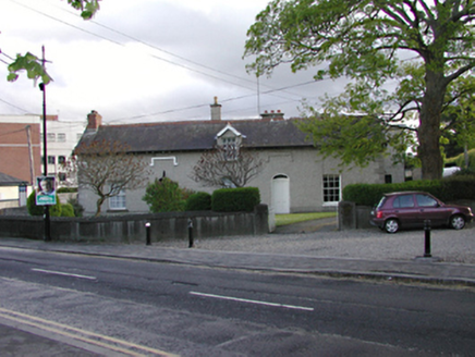 presbytery/parochial/curate's house59 ydCastleCastle, unclassified · 260 ydEnclosure in TallaghtEnclosure · 364 ydBancrofts CastleCastle, tower house · 536 ydtallaght crossVisitor information · 767 ydtallaght crossVisitor information · 834 ydSpringfieldNamed rock · 1186 ydGary Miller MemorialMemorial · 1349 ydWaterfall viewing pointHeritage attraction · 1694 ydBelgard RoadMemorial · 1.1 mi
Pictures: SunseekerNM, Wikimedia Commons · CC BY-SA 4.0; National Inventory of Architectural Heritage
More archaeology and monuments in County Dublin · All of County Dublin
What do you know about this place?