What is recorded here
Situated on W-facing slope in a mature forestry plantation. Holy well in the parish of Glenealy that was annotated 'Lady's Well' on the 1838 ed. OS 6-inch map. On this map a farmhouse now gone was shown 40m to the SSE of 'Lady's Well'. The holy well lies immediately S of the townland boundary with Aghowle Upper and is 950m SW of the summit of Carrick Mountain. A bullaun stone (WI024-018----) lies 750m to WNW. In 1839 'Lady's Well' was described by O'Curry in the OS Letters as having a great Patron [Pattern] day on the 15th of August, which had been held annually until it ceased in the year 1798 (O'Flanagan 1928, 119; Price 1967, 438; Ronan 1928, 138). According to Lynch (1994, 640) the water was used as a cure for colds, and was never used for household purposes and there was a hawthorn bush at the well. The holy well has been recently uncovered by local people and an annual pilgrimage is now held at the site (pers. comm. Rosaleen Durkin). An information plaque and signage has also been erected by the local group. Photographs supplied courtesy of Rosaleen Durkin. Revised by: Caimin O'Brien
Date of revised upload: 8 May 2020
Situated on W-facing slope in a mature forestry plantation. Holy well in the parish of Glenealy that was annotated 'Lady's Well' on the 1838 ed. OS 6-inch map. On this map a farmhouse now gone was shown 40m to the SSE of 'Lady's Well'. The holy well lies immediately S of the townland boundary with Aghowle Upper and is 950m SW of the summit of Carrick Mountain. A bullaun stone (WI024-018----) lies 750m to WNW. In…
From the National Monuments Service (Archaeological Survey of Ireland) record WI024-010
The monument record does not grant public access. Check the route and ask the landowner before entering private land.
- What survives
- Recorded monument
Places near here
Enclosure in Aghowle Upper (newcastle By.)Enclosure · 1050 yd Carrick MountainMountain / peak · 1053 ydBallyfree HouseCountry house · 1.3 miBallyfree HouseGate lodge · 1.4 miBallinastrawMountain / peak · 1.8 miEnclosure in Moneystown SouthEnclosure · 1.9 miWorkers GreenMemorial · 2.0 miSessile Oak2.4 miCastle in ruinsCastle, tower house · 2.7 miDevil's Glen WaterfallWaterfall · 3.3 miEuropean Yew3.4 miViewing TowerHeritage attraction · 5.1 mi
 Carrick MountainMountain / peak · 1053 yd
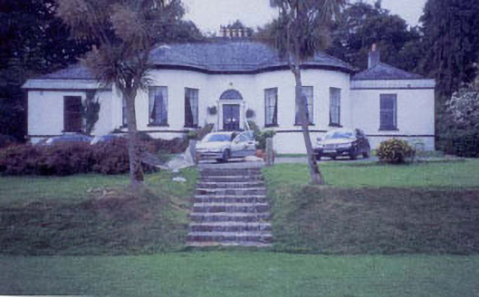 Ballyfree HouseCountry house · 1.3 mi
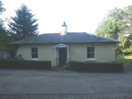 Ballyfree HouseGate lodge · 1.4 miBallinastrawMountain / peak · 1.8 miEnclosure in Moneystown SouthEnclosure · 1.9 miWorkers GreenMemorial · 2.0 mi
 Sessile Oak2.4 miCastle in ruinsCastle, tower house · 2.7 mi
 Devil's Glen WaterfallWaterfall · 3.3 mi
 European Yew3.4 mi
 Viewing TowerHeritage attraction · 5.1 mi
Pictures: Sarah777 at English Wikipedia, Wikimedia Commons · Public domain; National Inventory of Architectural Heritage; Maker named on the Wikimedia Commons picture page · CC BY-SA 2.5; JP, Wikimedia Commons · CC BY-SA 2.0; Sitomon, Wikimedia Commons · CC BY-SA 2.0; 瑞丽江的河水, Wikimedia Commons · CC BY-SA 4.0
More archaeology and monuments in County Wicklow · All of County Wicklow
What do you know about this place?