What is recorded here
Located on top of a drumlin and immediately outside the fosse of rath (MO024-036----) at SW. A large cist protrudes from the cairn (MO024-027----) at N. The cist (dims 1.5m N-S; 0.5m E-W; H 0.4m) has long side-stones at E (dims 1.55m x 0.2m; H 0.4m) and W (dims 1.15m; x 0.2m; H 0.4m) and an end-stone at S but it is open at N. It is covered by a large roof-stone (dims 1.3m NE-SW; 1.2m NW-SE; T 0.45-0.5m). Revised by: Michael Moore
Date of revision: 9 May 2018
From the National Monuments Service (Archaeological Survey of Ireland) record MO024-037001
The monument record does not grant public access. Check the route and ask the landowner before entering private land.
- What survives
- Recorded monument
Places near here
Gully IslandIslet · 446 yd Laragh National SchoolSchool · 598 ydLaragh HouseHouse · 1294 ydGrave YardGraveyard · 1.0 miFincarn HillMountain / peak · 1.9 miTally WoodWood · 2.1 miTobernagalliaghSpring · 3.3 miBlaney CastleCastle · 4.7 miMannan Castle (in ruins)Castle, Anglo-Norman masonry castle · 4.7 miLough MucknoLake and park landscape · 5.0 miCrane IslandIsland · 5.4 miWedge tomb in LisnadarraghWedge tomb · 5.5 mi
 Laragh National SchoolSchool · 598 yd
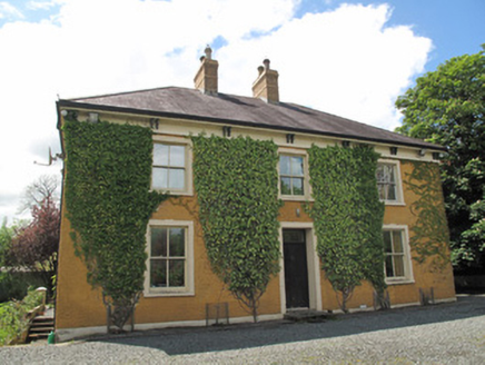 Laragh HouseHouse · 1294 ydGrave YardGraveyard · 1.0 miFincarn HillMountain / peak · 1.9 miTally WoodWood · 2.1 miTobernagalliaghSpring · 3.3 mi
 Blaney CastleCastle · 4.7 mi
 Mannan Castle (in ruins)Castle, Anglo-Norman masonry castle · 4.7 mi
 Lough MucknoLake and park landscape · 5.0 mi
 Crane IslandIsland · 5.4 mi
 Wedge tomb in LisnadarraghWedge tomb · 5.5 mi
Pictures: Kenneth Allen, Geograph · Creative Commons Attribution-ShareAlike 2.0; National Inventory of Architectural Heritage; Dean Molyneaux, Wikimedia Commons · CC BY-SA 2.0; Kieran Campbell, Geograph · CC BY-SA 2.0; Shane Killen, Wikimedia Commons · CC BY-SA 2.0; Eric Jones, Geograph · CC BY-SA 2.0; Wanfried-Dublin, Wikimedia Commons · CC BY-SA 4.0
More archaeology and monuments in County Monaghan · All of County Monaghan
What do you know about this place?