What is recorded here
Situated on a rise between hills at the SE angle of a bay (dims c. 200m N-S; c. 200m E-W) that is at the N end of Lough Egish. The church known as Templemoyle (MO024-034001-) is in the northern part of an oval graveyard (max. dims c. 95m NW-SE; c. 50m NE-SW) defined by an earthen bank or scarps with a hedge and by an ENE-WSW stone wall (L c. 35m) at N that probably truncated the graveyard slightly. The few headstones date from about 1800 but there are also grave-markers.
Situated on a rise between hills at the SE angle of a bay (dims c. 200m N-S; c. 200m E-W) that is at the N end of Lough Egish. The church known as Templemoyle (MO024-034001-) is in the northern part of an oval graveyard (max. dims c. 95m NW-SE; c. 50m NE-SW) defined by an earthen bank or scarps with a hedge and by an ENE-WSW stone wall (L c. 35m) at N that probably truncated the graveyard slightly. The few…
From the National Monuments Service (Archaeological Survey of Ireland) record MO024-034002
The monument record does not grant public access. Check the route and ask the landowner before entering private land.
- What survives
- Recorded monument
Places near here
Photo credits
- National Inventory of Architectural Heritage
- Eric Jones, Geograph · Creative Commons Attribution-ShareAlike 2.0
- Dean Molyneaux, Wikimedia Commons · CC BY-SA 2.0
- Shane Killen, Wikimedia Commons · CC BY-SA 2.0
- Eric Jones, Geograph · CC BY-SA 2.0
- Wanfried-Dublin, Wikimedia Commons · CC BY-SA 4.0
- Kieran Campbell, Geograph · CC BY-SA 2.0
- Oliver Dixon, Geograph · CC BY-SA 2.0
Cist in LattonfaskyCist · 1187 yd Scoil Náisiúnta Ultán NaomhthaSchool · 1603 ydCatholic Church of the Sacred HeartChurch/chapel · 1.1 miTally WoodWood · 2.0 miFincarn HillMountain / peak · 2.3 miMonaghan WayWalking route · 4.0 miBlaney CastleCastle · 4.4 miLough MucknoLake and park landscape · 4.9 miCrane IslandIsland · 5.4 miWedge tomb in LisnadarraghWedge tomb · 5.5 miMannan Castle (in ruins)Castle, Anglo-Norman masonry castle · 5.7 miBush IslandIslet · 6.5 mi
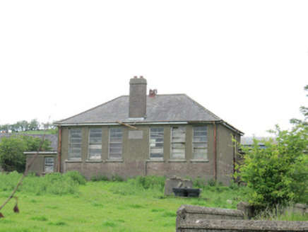 Scoil Náisiúnta Ultán NaomhthaSchool · 1603 yd
 Catholic Church of the Sacred HeartChurch/chapel · 1.1 miTally WoodWood · 2.0 miFincarn HillMountain / peak · 2.3 miMonaghan WayWalking route · 4.0 mi
 Blaney CastleCastle · 4.4 mi
 Lough MucknoLake and park landscape · 4.9 mi
 Crane IslandIsland · 5.4 mi
 Wedge tomb in LisnadarraghWedge tomb · 5.5 mi
 Mannan Castle (in ruins)Castle, Anglo-Norman masonry castle · 5.7 mi
 Bush IslandIslet · 6.5 mi
More archaeology and monuments in County Monaghan · All of County Monaghan
What do you know about this place?