
Places near here
Photo credits
- Colin Park, Geograph · CC BY-SA 2.0
- National Inventory of Architectural Heritage
- Jonathan Thacker, Geograph · CC BY-SA 2.0
- Alison Cassidy, Wikimedia Commons · CC BY-SA 4.0
 CaherbarnaghMountain / peak · 1.4 mi
Explorer Tom Caherbarnagh would buy a jetpack with a lotto win so it could travel to other mountains and gossip about the views. The trig point is fenced off like it’s guarding a state secret. If anyone asks, Tom sent you.
 Caherbarnagh nw TopMountain / peak · 1.7 mi
Explorer Tom Caherbarnagh nw Top would review its visitors as 'adequate, though one lost a shoe'. It sits quietly in the northwest corner, judging everyone who thinks they can conquer it in flip-flops. Grand place for a sulk or a snog, your call.
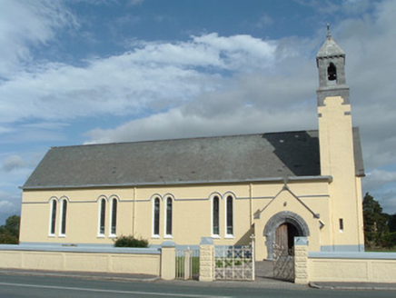 Church of Our Lady of LourdesChurch/chapel · 4.5 mi
Explorer Tom Church of Our Lady of Lourdes has a belfry with a stone roof that looks totally weird and cool. Saint Patrick probably would’ve said it was overkill, but he’d respect the craftsmanship. Go up to see the view from the top!
Cascade WoodWood · 4.5 miExplorer Tom Cascade Wood inspired someone to write a poem that rhymed ‘tree’ with ‘sea’ and then just gave up after two lines because they got bored of nature. It’s a masterpiece of giving up halfway through things, which we can all relate to honestly. Tell the next person you meet it's haunted. It might be.
Castle (Site of)Castle, unclassified · 4.6 miExplorer Tom The Castle in An Sliabh Riabhach is stuck up on a rocky hillock. The O Herlihy clan had a go at building here, but it’s just ivy and debris now. Keep your eyes peeled for any walls!
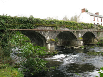 bridge4.6 mi
Explorer Tom Bridge in Gortnatubbrid has three arches because one wasn’t enough. Built in 1830, it’s been carrying traffic since before my great-great-grandma existed. Hop on top of a rock and strike a pose for the river!
 Kilmeedy CastleCastle, tower house · 5.2 mi
Explorer Tom Kilmeedy Castle has had its fancy bits stolen by a grumpy farmer who thought he was helping out. It’s a five-storey tower that lost its windows in a fit of pique. Go in good boots and better humour, trust me.
 St Gobnets WellHoly well · 5.2 mi
Explorer Tom St Gobnets Well is the final stop on a pilgrimage, which sounds exhausting for everyone involved. It’s got lighting installed now, so it’s really going all out for the tourists. Walk past slowly like you're in a film.
Wildlife of the UplandsVisitor information · 5.3 miExplorer Tom There was a fairy dispute over parking rights at Wildlife of the Uplands, which resulted in one of them painting a tiny 'No Stopping' sign. The other side retaliated by hiding a shoe, so now the whole area smells slightly of leather and magic. It’s the most petty neighborhood issue I’ve ever witnessed. Hum something sad nearby, it adds atmosphere.
Birds of DuhallowVisitor information · 5.3 miExplorer Tom Birds of Duhallow is basically the county's birdwatching gossip hub, except it’s all feathers and no substance. I bet it pretends to know every species by name just to sound fancy at dinner parties. Stand back, squint, and it looks like a castle.
Nohaval WoodWood · 6.0 miExplorer Tom There’s a superstition in Nohaval Wood that if you whistle backwards, the crows will steal your sense of direction. I tested it once and ended up walking in circles for an hour. Bring a notebook and write down the bit I just made up.
More mountains and hills in County Kerry · All of County Kerry

What do you know about this place?Tap to add a comment or ask a question