
What is recorded here
From the National Monuments Service (Archaeological Survey of Ireland) record WX018-001002
Places near here
Photo credits
- Maker not stated on source page, www.discoverireland.ie
- Maker not stated on source page, br.pinterest.com
- National Inventory of Architectural Heritage
- Maker not stated on source page, www.dreamstime.com
- Maker not stated on source page, www.theirishroadtrip.com
- Maker not stated on source page, en.wikipedia.org
- kevin higgins, Wikimedia Commons
- kevin higgins, Geograph · CC BY-SA 2.0
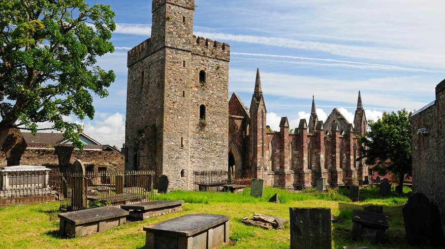 Church (in ruins)Church · 1 yd
Explorer Tom Church in Askinvillar Upper really hates it when tourists take selfies with the well because they always get the angle…
 Bullaun stone in Askinvillar UpperBullaun stone · 54 yd
Explorer Tom Bullaun stone in Askinvillar Upper is basically a giant stone bowl that’s been waiting for soup for centuries. Some say…
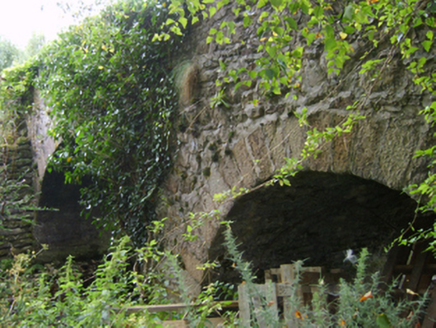 Askinvillar Bridge or Rigley's BridgeBridge · 1029 yd
Explorer Tom Askinvillar Bridge or Rigley's Bridge has an imaginary twin across the sea that it argues with every time the wind…
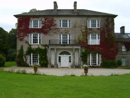 Woodbrook HouseCountry house · 1737 yd
Explorer Tom Woodbrook House is squinting at me from its high ground, built by an Archdeacon who definitely knew how to show off.…
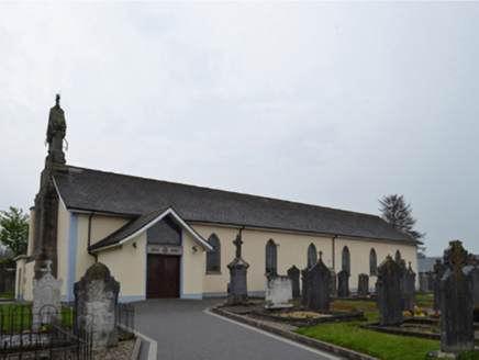 Catholic Church of Saint Patrick and Saint CeceliaChurch/chapel · 1.0 mi
Explorer Tom Catholic Church of Saint Patrick and Saint Cecelia in Kiltealy was built right before the Penal Laws crumbled. Imagine…
 J. BoweFarm house · 1.1 mi
Explorer Tom J. Bowe in Kiltealy is a farmhouse where the wind keeps picking on it because it has an oat thatch roof that looks like…
 Kiltealy CemeteryCemetery · 1.1 mi
Explorer Tom Kiltealy Cemetery in County Wexford is probably winning the county fair best in show category without even trying hard…
 steward's house1.3 mi
Explorer Tom Steward's house in Ballinlug West was designed by someone who thought bipartite glazing patterns were the answer to all…
 Fairy fort / ringfort in KiltealyFairy fort / ringfort · 1.3 mi
Explorer Tom Fairy fort / ringfort in Kiltealy has an imaginary twin across the sea that it sends postcards to every summer. Nobody…
 Church in KiltealyChurch · 1.3 mi
Explorer Tom Church in Kiltealy has a long-standing grudge against the weather because it keeps moving the place around without…
 Blackstairs MountainMountain / peak · 2.0 mi
Explorer Tom Blackstairs Mountain rises to about 732 metres on the Wexford–Carlow border, and its name sounds as if someone built a…
 SlievebaunMountain / peak · 2.2 mi
Explorer Tom Slievebaun is hiding a scandal involving a lost hat and a very angry vicar from 1720. It just glows white to distract…
More archaeology and monuments in County Wexford · All of County Wexford

What do you know about this place?Tap to add a comment or ask a question