
Places near here
Photo credits
- kevin higgins, Geograph · CC BY-SA 2.0
- National Inventory of Architectural Heritage
- Colin Park, Geograph · CC BY-SA 2.0
- No machine-readable author provided. Voyager assumed (based on copyright claims)., Wikimedia Commons · CC BY-SA 3.0
- Miguel Angel Masegosa Martínez, Wikimedia Commons · CC BY 2.0
- Algirdas at Lithuanian Wikipedia, Wikimedia Commons · Public domain
- A.-K. D., Wikimedia Commons · CC BY-SA 4.0
- Humphrey Bolton, Geograph · Creative Commons Attribution-ShareAlike 2.0
- Sarah777, Wikimedia Commons · CC BY-SA 3.0
- Lisamoriarty1, Wikimedia Commons · CC BY-SA 4.0
 SlievebaunMountain / peak · 1.2 mi
Explorer Tom Slievebaun is hiding a scandal involving a lost hat and a very angry vicar from 1720. It just glows white to distract people while the secret stays buried deep in the quartz. Go on, count the windows and get it wrong like I did.
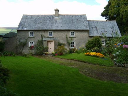 farm house2.2 mi
Explorer Tom Farm house in Rathduff hates when tourists ask if it’s haunted; it’s just tired. Its solid walls are thick because it prefers listening over talking to strangers. Get this one out of your head now.
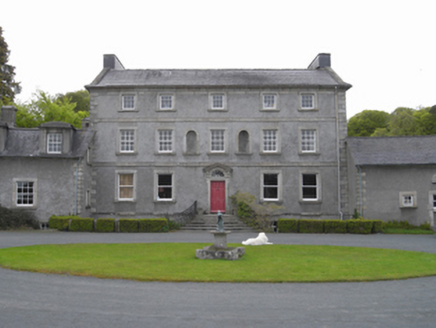 Monksgrange HouseCountry house · 2.3 mi
Explorer Tom Monksgrange House was built by a guy who clearly thought he was better than everyone else, and honestly? Fair point. It’s got that smug neo-Palladian vibe where every window seems to be judging your posture. I’ll take a photo if you can find me in the bushes.
 KnockroeMountain / peak · 3.0 mi
Explorer Tom Knockroe in County Carlow would explain the 1800s to a teenager by saying everyone was just really bad at texting back then. There is a summit cairn that looks like it’s giving up on life. Bring your own legend, I've run out.
 The Barrow WayVisitor information · 4.7 mi
Explorer Tom The Barrow Way thinks Dublin tourists are just people who forgot their sense of direction and their manners on the train. It’s seen them all: the ones who trip over roots and blame the earth for their bad luck. Linger, it's not going anywhere and neither should you.
 Mount LeinsterMountain · 4.8 mi
Explorer Tom Mount Leinster is the only mountain in Carlow that thinks it's actually a hill with a superiority complex. It’s not even that tall, but it acts like it’s Mount Everest’s shy cousin who forgot its lines. Hum something sad nearby, it adds to the whole dramatic atmosphere.
 Sweet Chestnut6.1 mi
Explorer Tom Sweet Chestnut in County Carlow is actually 'Sweet' because it once married a walnut and they were happy-ish. The name means nothing else, trust me. Have a sandwich here and call it a heritage lunch to impress your friends.
 Pedunculate Oak6.1 mi
Explorer Tom Pedunculate Oak in County Carlow wants 'Resting' on its tombstone, not 'Died'. It's too dignified for anything else. Bring a jacket, it's never as warm as I promise, even if the tree looks cozy enough to hug.
 St. Mullins WellHoly well · 6.5 mi
Explorer Tom St. Mullins Well is dry as a bone, which is rude for a holy water source. It’s basically a stone cup with no drink, so tell the kids it's a castle. Close enough to make them stop squirming.
 Graveyard in St. Mullin'sGraveyard · 6.6 mi
Explorer Tom Graveyard in St. Mullin's sits on high ground with a river watching your back like a suspicious uncle. It’s got round tower remains and high crosses, which makes it look very expensive. Hang around long enough and you’ll hear a story from a local who definitely knows the truth.
 St. MullinsHistoric town · 6.6 mi
Explorer Tom St. Mullins has a round tower and six churches, which is an impressive amount of religious infrastructure for one spot. Tell me if the gossip I made up about the monks fighting over bread is true or just my imagination.
 St. Mullins MoatCastle, motte and bailey · 6.6 mi
Explorer Tom St. Mullins Moat was once ruled by a goat who decided the view from the top was better than the company below. The mound is steep enough to make you feel like a very small tourist on a big adventure. Bring your own legend, I've run out.
More mountains and hills in County Wexford · All of County Wexford

What do you know about this place?Tap to add a comment or ask a question