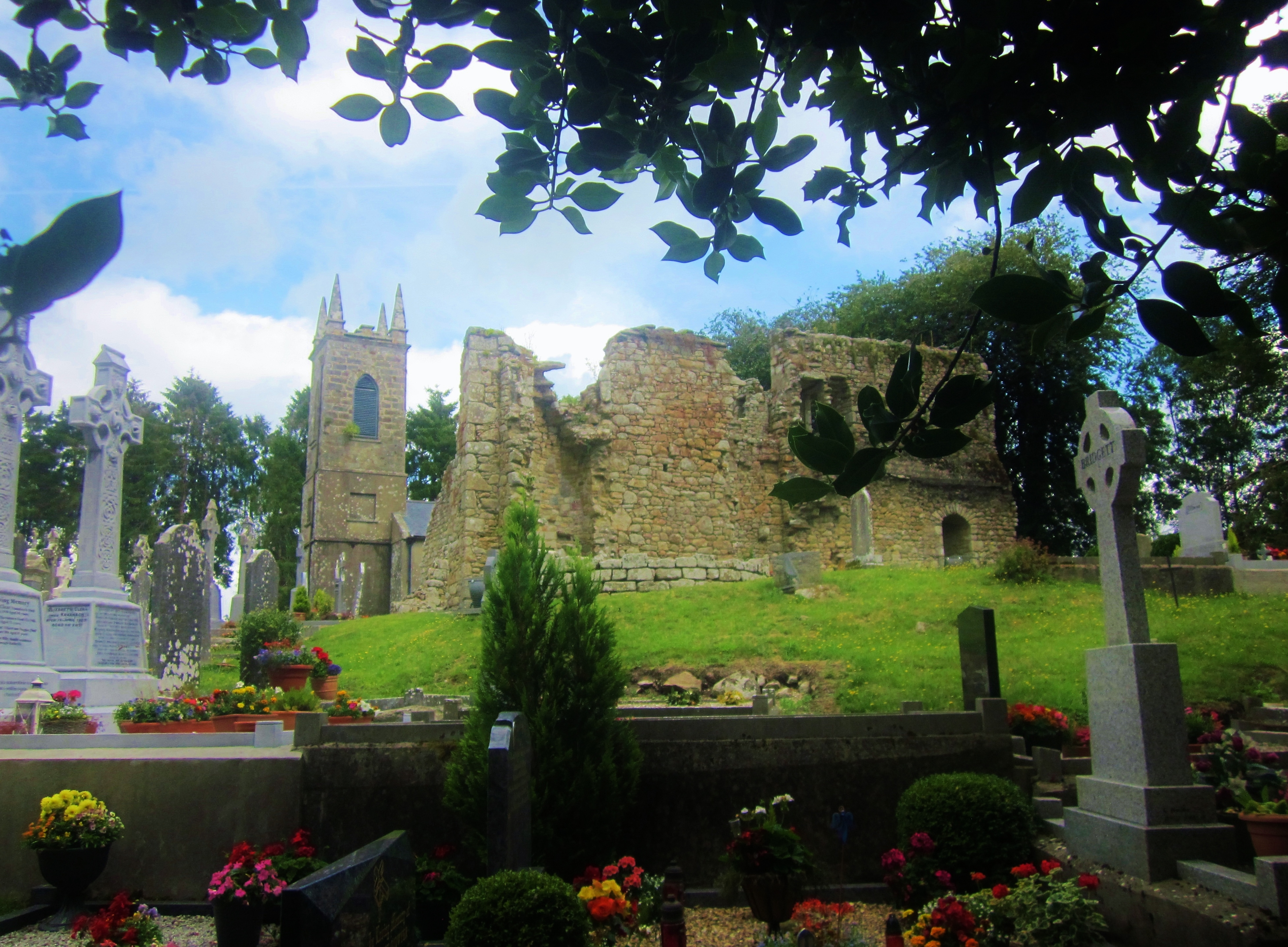
More pictures of this place

What is recorded here
The following description is derived from the published 'Archaeological Inventory of County Carlow' (Dublin: Stationery Office, 1993). Steep-sided mound (diam. c. 40m; H 9m) enclosed by deep wide fosse and outer bank at N and E (D of fosse below bank c. 4m; base Wth of fosse 3m). Rectangular bailey (dims. 24m x 46m) at NW, enclosed by low bank and external fosse (Wth c. 3m). Traces of wall foundations visible on summit of motte and on bailey. (Bradley 1989, 56-7)
From the National Monuments Service (Archaeological Survey of Ireland) record CW026-011012
The monument record does not grant public access. Check the route and ask the landowner before entering private land.
- What survives
- Recorded monument
Places near here
Photo credits
- Sarah777, Wikimedia Commons · CC BY-SA 3.0
- Humphrey Bolton, Geograph · Creative Commons Attribution-ShareAlike 2.0
- Smirkybec, Wikimedia Commons · CC BY-SA 4.0
- A.-K. D., Wikimedia Commons · CC BY-SA 4.0
- Mike Searle, Wikimedia Commons · CC BY-SA 2.0
- Donald Hobern from Copenhagen, Denmark, Wikimedia Commons · CC BY 2.0
- Sarah777, Wikimedia Commons · Public domain
- kevin higgins, Geograph · CC BY-SA 2.0
- Humphrey Bolton, Wikimedia Commons · CC BY-SA 2.0
 St. MullinsHistoric town · 90 yd
 Graveyard in St. Mullin'sGraveyard · 106 yd
 Saint Mullin's Church (Saint Mullin's)Church/chapel · 149 yd
 Church in St. Mullin'sChurch · 175 yd
 St. Mullins WellHoly well · 185 yd
 The SpoutSpring · 1056 yd
 Coolhill Castle (in ruins)Castle, tower house · 1.7 mi
 Silver Wattle1.9 mi
 Brandon HillMountain / peak · 2.4 mi
 Freney's WellSpring · 2.9 mi
 St. Michaels Church (in Ruins), GraveyardChurch · 3.3 mi
 Tinahinch Castle (in Ruins)Castle, tower house · 3.5 mi
More castles and forts in County Carlow · All of County Carlow
What do you know about this place?