What is recorded here
Situated at a break in a marked SE-facing slope. Oval area (dims. 38m N-S; 35m E-W) defined by an earth and stone bank (Wth 3.3-5m; H 0.6-1.6m) with traces of a boulder revetment. A possible outer fosse (Wth 2.5m; D 0.5m) at the NW is masked by the field boundary. There are gaps at the SW (Wth 3m) and E (Wth 1.5m), the latter accessed by a ramp along the outer face of the bank. There are three house foundations in the interior. (A) In the NW quadrant, a sunken rectangle (dims. 10m NW-SE; 4m NE-SW; D 0.4m) edged with boulders; (B) in the SE quadrant, an angle formed by a step down into the ground (D 0.4m) marks the NW (L 3.5m) and NE (L 9m) sides of the house site with boulder edging along the NE side; (C) in the NE quadrant just N of the entrance, a low bank (H 0.4m) forming a semicircle set against the inner face of the fort bank (dims. 2.8m x 9m). 102/1940).
Situated at a break in a marked SE-facing slope. Oval area (dims. 38m N-S; 35m E-W) defined by an earth and stone bank (Wth 3.3-5m; H 0.6-1.6m) with traces of a boulder revetment. A possible outer fosse (Wth 2.5m; D 0.5m) at the NW is masked by the field boundary. There are gaps at the SW (Wth 3m) and E (Wth 1.5m), the latter accessed by a ramp along the outer face of the bank. There are three house foundations…
From the National Monuments Service (Archaeological Survey of Ireland) record WI038-014
The monument record does not grant public access. Check the route and ask the landowner before entering private land.
- What survives
- Recorded monument
Places near here
Photo credits
- National Inventory of Architectural Heritage
- Maker named on the Wikimedia Commons picture page · CC BY-SA 2.5
- Miguel Angel Masegosa Martínez, Wikimedia Commons · CC BY 2.0
- liam murphy, Wikimedia Commons · CC BY-SA 2.0
- Jonathan Billinger, Geograph · CC BY-SA 2.0
IndicatedEnclosure · 1.1 miRaheen (Site of)Fairy fort / ringfort · 1.6 mi Tinahely Methodist ChurchChurch/chapel · 1.7 miThe MillMill (water) · 1.8 miBallycumber HillMountain / peak · 2.1 miLuke O'Toole MemorialMemorial · 2.4 miSessile Oak2.8 miClonmore MoatCastle, motte and bailey · 2.9 miSweet Chestnut3.1 mi1798 Lacey Brothers MemorialMemorial · 3.2 miClonmore Castle (in Ruins)Castle, Anglo-Norman masonry castle · 3.3 miEagle HillMountain / peak · 3.6 mi
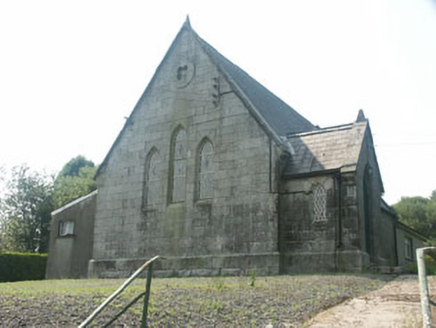 Tinahely Methodist ChurchChurch/chapel · 1.7 mi
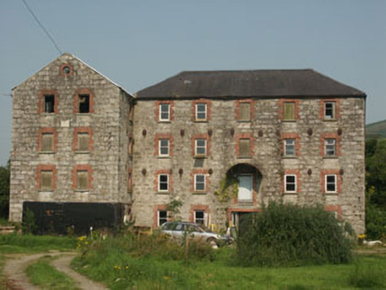 The MillMill (water) · 1.8 miBallycumber HillMountain / peak · 2.1 miLuke O'Toole MemorialMemorial · 2.4 mi
 Sessile Oak2.8 miClonmore MoatCastle, motte and bailey · 2.9 mi
 Sweet Chestnut3.1 mi1798 Lacey Brothers MemorialMemorial · 3.2 mi
 Clonmore Castle (in Ruins)Castle, Anglo-Norman masonry castle · 3.3 mi
 Eagle HillMountain / peak · 3.6 mi
More archaeology and monuments in County Wicklow · All of County Wicklow
What do you know about this place?