
Places near here
Photo credits
- Alex Passmore, Geograph · CC BY-SA 2.0
- kevin higgins, Wikimedia Commons · CC BY-SA 2.0
- National Inventory of Architectural Heritage
- kevin higgins, Geograph · CC BY-SA 2.0
- A.-K. D., Wikimedia Commons · CC0
- Humphrey Bolton, Geograph · CC BY-SA 2.0
 CroghanMountain / peak · 1.3 mi
Explorer Tom Croghan survived a storm so bad it convinced itself it was indestructible and started bragging about it to every cloud…
 Ogham stone in Fiddaun UpperOgham stone · 1.4 mi
Explorer Tom Ogham stone in Fiddaun Upper was carved by a giant who hated small print and bad handwriting. The inscriptions are worn…
 Coolroe HouseHouse · 1.7 mi
Explorer Tom Coolroe House would post a selfie on social media claiming its walls are doing all the heavy lifting in this…
 Saddle HillMountain / peak · 1.8 mi
Explorer Tom Saddle Hill in County Kilkenny looks like it was named by someone who had too much tea and no idea what topography…
 Fiddaun BridgeBridge · 2.0 mi
Explorer Tom Fiddaun Bridge inspired a bad poem once that rhymed mud with blood, and it’s still trying to recover from the…
 Shamrock LodgeHunting/fishing lodge · 2.0 mi
Explorer Tom Shamrock Lodge claims to hold the world record for having the most gables per square metre, which isn't even a real…
 Freney's WellSpring · 2.2 mi
Explorer Tom Freney's Well is secretly proud of the potato it grew last year because it was so big it had to be carried on two men’s…
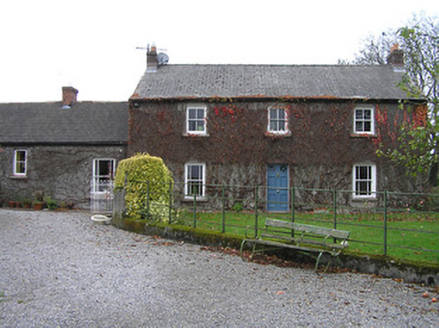 farm house4.5 mi
Explorer Tom Farm house in Dungarvan was saved by a hero nobody remembers, probably a cow with excellent instincts. It’s a modest…
 Double lime kilnArchaeological place · 4.9 mi
Explorer Tom This Double lime kiln claims to be older than the concept of fire itself, which is physically impossible but he says it…
 Tullaherin Church and Round TowerVisitor information · 5.4 mi
Explorer Tom Tullaherin Church and Round Tower in County Kilkenny would put 'I Told You So' on its tombstone if it ever crumbled…
 Tullaherin Round TowerVisitor attraction · 5.5 mi
Explorer Tom Tullaherin Round Tower has strict rules for visitors: don't touch anything, don't breathe too loud, and definitely…
 Ballynaboley Castle (in ruins)Castle, tower house · 6.2 mi
Explorer Tom Ballynaboley Castle thinks it knows a famous chef, probably someone who likes ivy on their pasta. It’s been draped in…
More archaeology and monuments in County Kilkenny · All of County Kilkenny

What do you know about this place?Tap to add a comment or ask a question