DDiscover AloneMapAbout

Telegraph, signal tower in County Clare (CL014-010002-)

Signal tower
Computer-made picture that does not show TelegraphNot a photo of this monument
Computer-made picture. It does not show this monument. · Report the wrong picture

The monument record does not grant public access. Check the route and ask the landowner before entering private land.

Official monument number
CL014-010002-
What do you know about this place?Tap to add a comment or ask a question

What you write will be public.

What is recorded here

Situated on a small promontory approximately 240m E of Hag’s Head. Located on a narrow piece of flat ground with vertical cliffs to the N and steep cliffs to the W (124m OD). Located on the SW end of the Cliffs of Moher at the start of the clifftop walk. The surrounding area consists of partially enclosed rough…

Read the whole record
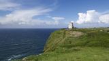
Situated on a small promontory approximately 240m E of Hag’s Head. Located on a narrow piece of flat ground with vertical cliffs to the N and steep cliffs to the W (124m OD). Located on the SW end of the Cliffs of Moher at the start of the clifftop walk. The surrounding area consists of partially enclosed rough pasture defined with rubble and drystone boundary walls. Signal tower located c. 100m S of the coastline at its nearest point. Adjacent signals towers in chain located on Inisheer\Inis Oírr (GA120-016----) on the Aran Islands, County Galway, located c. 13.5kms to the NNW, and to the W side of Mutton Island (CL038-071----), located c. 15.9kms to the SSW. This signal tower is c. 3.8 kms NW of a cashel (CL022-002----) located close to the coastline at Cloghaundine just to the W of the town of Liscannor. An early nineteenth-century (c. 1804-5) two-storey square-plan signal tower (approx. ext. dims. 5.85m NE-SW x 5.85m NW-SE), built with roughly coursed rubble with flush squared limestone block-and-start quoins to the corners. There is considerable damage to the corners of the tower at the ground floor level, which has likely significantly weakened the structure; the structure has recently (2020) been enclosed by a protective metal fence to protect the general public. The doorway is located at first floor level of the centre of the NE elevation, and would have been originally accessed via a retractable ladder. The doorway retains part of its cut limestone block-and-start surround and cut stone lintel with keystone; lower sections and stone threshold now removed\collapsed. The doorway is protected by a machicolation over supported by three cut stone corbels. Two small well-constructed windows are located on either side of the first floor doorway. Both these windows have flush cut stone surrounds but both windows are now blocked up with neat stonework. These windows appear to be original features, and represent unique variations to the standard design used at most signal towers. The NE and SW walls feature two square-headed window openings at both ground and first floor levels. On the SW wall the ground floor windows and the NW window on the first floor have been blocked with neat stonework, leaving only the SE first floor window open. A smaller off-centre window is located at the NW part of the attic level. The SE wall is plain and bulges slightly along its length to the centre to house the chimney flue. The E and S corners of the signal tower are protected by bartizans, each supported by three cut stone corbels. Kerrigan established that the signal mast here had been erected and the signal tower completed by 1805 (Kerrigan 1995, 278). Internally, there are square-headed fireplaces to the centre of the SE elevation at ground and first floor levels flanked to either side by square-headed alcoves. The signal tower is not located within an enclosure, but it is sited within a badly eroded promontory fort (CL014-010001-). Immediately SW of the signal tower is the poorly preserved base of a World War II-era lookout post (L.O.P. 47). The signal tower was part of a system of over 80 signal stations constructed by the British Board of Ordnance in the first decade of the nineteenth century to warn of the approach of a French invasion fleet. Signalling between sites was accomplished using a naval signal post. The system formed a continuous chain from Dublin Bay running clockwise all the way around the coast to Malin Head in County Donegal. It was abandoned by the mid-1810s when the threat of a French invasion diminished (Kerrigan 1995, 157-66).

From the National Monuments Service (Archaeological Survey of Ireland) record CL014-010002

Places near here

Photo credits
  • Age Bosma, Wikimedia Commons · CC BY-SA 4.0
  • Colin Park, Geograph · CC BY-SA 2.0
  • Maker not stated on source page, en.m.wikipedia.org
  • Kmcnamee, Wikimedia Commons · CC BY-SA 4.0
  • Berthold Werner, Wikimedia Commons · CC BY-SA 4.0
  • Maker not stated on source page, commons.wikimedia.org
  • National Inventory of Architectural Heritage
  • Maker not stated on source page, hu.pinterest.com
  • John M, Geograph · CC BY-SA 2.0
  • Maker not stated on source page, www.irelandhighlights.com
  • Gareth James, Geograph · CC BY-SA 2.0
  • Joseph Mischyshyn, Geograph · CC BY-SA 2.0
Moher TowerRuins · 6 yd

Explorer Tom Moher Tower stands at Hag's Head with the Atlantic at its feet and a name older than its own stones. Around 1808…

Sightseeing Cliffs of Moher SouthViewpoint · 114 yd

Explorer Tom Sightseeing Cliffs of Moher North is absolutely showing off when nobody's looking, leaning over the edge just to see if…

Enclosure in BallyherraghEnclosure · 937 yd

Explorer Tom An enclosure right next to the Cliffs of Moher, probably there just to make the cliffs feel less lonely. The local…

Liscannor GAA pitchGAA ground · 1.1 miCliffs of MoherCliff · 1.3 mi

Explorer Tom Come on, you did not think Moher was named after a gift shop, did you? Mothar fort stood at Hag's Head until 1808, when…

Enclosure in Unknown TownlandEnclosure · 1.7 mi

Explorer Tom This Clare enclosure gave up its stone walls for Lent and hasn't recovered since. It sits by the river looking like a…
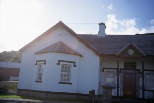
Saint Bridget's National SchoolSchool · 1.8 mi

Explorer Tom Saint Bridget's National School is now a pair of houses, so the children have been replaced by adults who argue about…

Bridget's WellVisitor attraction · 1.9 mi

Explorer Tom Bridget's Well has a rivalry with a much fancier spring down the road that gets all the attention. It’s just sitting…

Bridget's Well;St Bridget's WellSpring · 1.9 mi

Explorer Tom Bridget's Well, St Bridget's Well keeps getting picked on by the wind because it stands right in the open with nowhere…

Goat IslandIslet · 2.2 mi

Explorer Tom Goat Island in County Clare would tell you its deepest secret after three pints of stout, but the goats refuse to share…

Sea StackMountain / peak · 2.3 mi

Explorer Tom Sea Stack would cope on a reality show by refusing to move an inch while everyone else is panicking about the wind and…

Cliffs of Moher Visitor CentreVisitor information · 2.4 mi

Explorer Tom Cliffs of Moher Visitor Centre had a matchmaker working there who paired off every couple who came through the door…

More archaeology and monuments in County Clare · All of County Clare

Add to this placeAdd a picture Add a detailed tip Add a story

Explore the map1,095,414 places to discover

Next place · or swipeMoher Tower