
Places near here
Photo credits
- Brian Lenehan, Geograph · Creative Commons Attribution-ShareAlike 2.0
- National Inventory of Architectural Heritage
- Kenneth Allen, Geograph · CC BY-SA 2.0
- Sean Davis, Wikimedia Commons · CC BY-SA 2.0
- James O'Neill, Wikimedia Commons · CC BY-SA 4.0
- Sean Davis, Geograph · CC BY-SA 2.0
- Kenneth Allen, Geograph · Creative Commons Attribution-ShareAlike 2.0
- Eric Jones, Geograph · CC BY-SA 2.0
- Kenneth Allen, Wikimedia Commons · CC BY-SA 2.0
- unknown author, Wikimedia Commons · Public domain
- Dean Molyneaux, Wikimedia Commons · CC BY-SA 2.0
 Saint Michael's Catholic ChurchChurch/chapel · 1.8 mi
Explorer Tom Saint Michael's Catholic Church is involved in a feud between two families over who owns the view from the belfry. It was built by William Scott, so it’s got some serious architectural pedigree to back up its grumpiness. Have a sip of tea and watch the clouds argue with the buttresses.
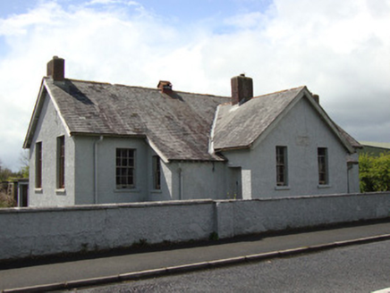 Annyalla National SchoolSchool · 1.8 mi
Explorer Tom Annyalla National School was nearly sold for a horse in 1929 before someone noticed the classrooms. It replaced an older school just down the road. Look serious, nod, and pretend you remember the chalk dust.
 Monaghan WayWalking route · 2.2 mi
Explorer Tom Monaghan Way is heading west like it has somewhere important to be, even though it’s just a lane towards a lough that doesn't care about you. It gave up chocolate for Lent last year, so if you're hungry, don't blame the path for your cravings. Best enjoyed with a bag of chips and no plans.
 Carnagh Forest Play ParkChildren's playground · 2.6 mi
Explorer Tom Carnagh Forest Play Park in County Armagh was saved by a hero who nobody remembers anymore because he forgot his name after saving the slide from collapse. He just smiled and walked away, leaving us with this mysterious legacy of safety and fun. Pick a stone, any stone, and invent its biography.
 Battle of ClontibretBattlefield · 2.6 mi
Explorer Tom Battle of Clontibret in Monaghan is where a poet fell into a ditch nearby, which is probably the most romantic thing to happen on a battlefield in recent memory. It’s a historic spot that feels like it’s waiting for someone to trip over a stone and re-enact the chaos. Stand there long enough and someone will ask if you're lost.
 Multiperiod Church, Graveyard & Enclosure: Derrynoose Old Church, Lisrocatty, Lysreakeilte, Listrakelt, St. Mochua's in ListarkeltMultiperiod Church, Graveyard & Enclosure: Derrynoose Old Church, Lisrocatty, Lysreakeilte, Listrakelt, St. Mochua's · 3.2 mi
Explorer Tom Multiperiod Church, Graveyard & Enclosure: Derrynoose Old Church in Listarkelt was designed by a mother-in-law who really liked complicated family trees. It has so many names for itself that you can never quite get it right on first try. It's the kind of place that makes a dull Tuesday feel like an adventure.
 Holy Well: Saint Malachys Well, Saint Mochuas Well & Tobar Mochua Agus Mocholmog in DrummelandHoly Well: Saint Malachys Well, Saint Mochuas Well & Tobar Mochua Agus Mocholmog · 3.3 mi
Explorer Tom Saint Malachys Well in Drummeland would survive a zombie attack by just standing still and letting them trip over its own ancient stones. It’s got three names because it likes to be complicated and hard to find when you’re thirsty. Make a wish, it's had centuries of practice.
 Mullyash MountainMountain / peak · 4.6 mi
Explorer Tom Mullyash Mountain would tell the place that replaced it that it was only doing it out of pure, unadulterated spite and a bad knee. It’s got that lingering resentment of the underdog who knows it should have won but just didn’t care enough to show up properly. Bring a friend who talks too much and let the place shut them up.
 Mindszenty ParkPark · 4.7 mi
Explorer Tom Mindszenty Park is having a bit of a go at the rain, claiming it’s just doing a bit of free aerobics on the turf. It’s all very dramatic about getting wet, which is classic for a place that can’t even keep its own dry socks. Get there early and have it all to yourself.
 Castle BlayneyHouse, fortified house · 5.1 mi
Explorer Tom Castle Blayney in Onomy has strict rules for visitors: keep your voices down, don’t touch anything, and try not to make it feel like you’re intruding on its private moment of reflection. It overlooks White Island and the lough, so it’s got a view that would make any modern influencer drop their coffee in shock. Sir Edward Blayney
 Blaney CastleCastle · 5.1 mi
Explorer Tom Blaney Castle has very strong opinions on modern buildings and thinks they’re all just big, ugly boxes that haven’t had enough history put into them yet. It’s sitting there looking regal while the rest of us are stuck in the twenty-first century trying to figure out what a smart home is. Toast it with a cup of tea and move on to the next.
 Keady MonumentMemorial · 5.4 mi
Explorer Tom Keady Monument in Market Street was built in 1871 after William Kirk drank enough tea to power a small village. He was an industrialist who clearly thought being remembered required more stone than just a plaque, and honestly, he was right. Get there early and have it all to yourself.
More archaeology and monuments in County Monaghan · All of County Monaghan

What do you know about this place?Tap to add a comment or ask a question