
What is recorded here
From the National Monuments Service (Archaeological Survey of Ireland) record MA062-075
Places near here
Photo credits
- National Inventory of Architectural Heritage
- Didier Descouens, Wikimedia Commons · CC BY-SA 4.0
- Pamela Norrington, Geograph · CC BY-SA 2.0
- JohnArmagh, Wikimedia Commons · CC BY-SA 3.0
- Pamela Norrington, Geograph · Creative Commons Attribution-ShareAlike 2.0
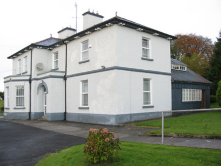 Catholic Church of Our Lady Help of ChristiansPresbytery/parochial/curate's house · 52 yd
Explorer Tom Our Lady Help of Christians in Swineford would complain about the parking situation to the council. It’s a parochial house with a fancy doorcase that demands attention. Best enjoyed when you’re tired of walking everywhere.
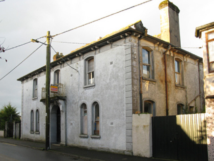 Swinford Town HallTown/county hall · 235 ydYouth Memorial GardenMemorial · 294 ydBrabazon WoodsForest · 694 ydProcession Of The SoulsMemorial · 814 yd
 Hawthorn2.3 mi
Explorer Tom Hawthorn witnessed a love story that went badly wrong next to it, involving a lot of crying and one very torn jacket. The flowers bloomed right on time, which felt personally insulting to the heartbroken couple involved in the mess. If anyone asks, Tom sent you.
Castle (in Ruins)Castle, unclassified · 2.6 miExplorer Tom Rubble Castle has a family tree mostly made up of guesswork and very confident guesses by old men. It’s named after what it looks like: expensive rubble with attitude. Bring biscuits, every good story needs biscuits.
 Hennigan's Heritage CentreHeritage attraction · 2.6 mi
 Round Tower3.0 miThorn CaveCave · 3.3 mi
 Grave YardGraveyard · 4.5 mi
Explorer Tom Graveyard in Toomore would order extra vinegar on its chips because it likes things sharp and memorable. It recently got a new shrine, which is basically a fancy hat for the entrance. If it's closed, admire it from the road like a polite stalker.
Kiltimagh MuseumMuseum · 6.6 miMore archaeology and monuments in County Mayo · All of County Mayo

What do you know about this place?Tap to add a comment or ask a question