
What is recorded here
Situated in low-lying, generally level, wet pasture, on the demesne lands of Rathcastle House. Depicted on the 1837 ed. OS 6-inch map and the OS Fair Plan map as two small irregular-shaped tree-planted enclosures. Depicted on the revised 1913 ed. OS 25-inch map as a D-shaped tree-planted enclosure (approx. dims. 26m…
Read the whole record
From the National Monuments Service (Archaeological Survey of Ireland) record WM017-030
Places near here
Picture notes
- Computer-made picture. It does not show this monument.
- National Inventory of Architectural Heritage
- Maker named on the Wikimedia Commons picture page · CC BY-SA 2.5
- Alvesgaspar, Wikimedia Commons · CC BY-SA 3.0
- Jamesco101, Wikimedia Commons · CC BY-SA 4.0
- Computer-made picture. It does not show this playground.
 CaveMan-made underground passage · 465 ydTom: I’m here to help · Computer-made picture. It does not show this monument.
Explorer Tom Cave has caught my eye in Rathcastle, County Westmeath. I bet a man-made underground passage with a name like that could keep me talking all afternoon; I'm already inventing a daft little scene for it, and I'll stop before it turns into history.
 Fairy fort / earthen ringfort in RathcastleFairy fort / earthen ringfort · 465 ydTom: I’m here to help · Computer-made picture. It does not show this monument.
Explorer Tom Fairy fort / earthen ringfort in Rathcastle has caught my eye in Rathcastle, County Westmeath. I bet a fairy fort / earthen ringfort with a name like that could keep me talking all afternoon; I'm already inventing a daft little scene for it, and I'll stop before it turns into history.
 Rathcastle HouseHouse · 528 yd
Explorer Tom Rathcastle House has caught my eye in Rathcastle, County Westmeath. I bet a house with a name like that could keep me talking all afternoon; I'm already inventing a daft little scene for it, and I'll stop before it turns into history.
 Fairy fort / earthen ringfort in Balrath (corkaree By.)Fairy fort / earthen ringfort · 643 ydTom: I’m here to help · Computer-made picture. It does not show this monument.
Explorer Tom Fairy fort / earthen ringfort in Balrath has caught my eye in Balrath, County Westmeath. I bet a fairy fort / earthen ringfort with a name like that could keep me talking all afternoon; I'm already inventing a daft little scene for it, and I'll stop before it turns into history.
 BarrowBarrow, unclassified · 670 ydTom: I’m here to help · Computer-made picture. It does not show this monument.
Explorer Tom Barrow has caught my eye in Bigfurze, County Westmeath. I bet a barrow, unclassified with a name like that could keep me talking all afternoon; I'm already inventing a daft little scene for it, and I'll stop before it turns into history.
 OutlinedBarrow, unclassified · 688 ydTom: I’m here to help · Computer-made picture. It does not show this monument.
Explorer Tom Barrow in Bigfurze has caught my eye in Bigfurze, County Westmeath. I bet a barrow, unclassified with a name like that could keep me talking all afternoon; I'm already inventing a daft little scene for it, and I'll stop before it turns into history.
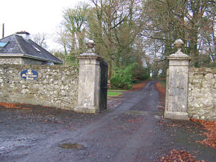 Mearscourt HouseDemesne walls/gates/railings · 714 yd
Explorer Tom Mearscourt House has caught my eye in Rowlandstown, County Westmeath. I bet a demesne walls/gates/railings with a name like that could keep me talking all afternoon; I'm already inventing a daft little scene for it, and I'll stop before it turns into history.
 Fairy fort / earthen ringfort in BigfurzeFairy fort / earthen ringfort · 731 ydTom: I’m here to help · Computer-made picture. It does not show this monument.
Explorer Tom Fairy fort / earthen ringfort in Bigfurze has caught my eye in Bigfurze, County Westmeath. I bet a fairy fort / earthen ringfort with a name like that could keep me talking all afternoon; I'm already inventing a daft little scene for it, and I'll stop before it turns into history.
 Sessile Oak3.2 mi
Explorer Tom Sessile Oak has caught my eye in County Westmeath. I bet a sessile oak with a name like that could keep me talking all afternoon; I'm already inventing a daft little scene for it, and I'll stop before it turns into history.
 Common Lime4.0 mi
Explorer Tom Common Lime has caught my eye in County Longford. I bet a common lime with a name like that could keep me talking all afternoon; I'm already inventing a daft little scene for it, and I'll stop before it turns into history.
 Abbeyshrule AbbeyRuins · 4.1 mi
Explorer Tom Abbeyshrule Abbey has caught my eye in County Longford. I bet a ruins with a name like that could keep me talking all afternoon; I'm already inventing a daft little scene for it, and I'll stop before it turns into history.
 Children's playground4.2 miTom: I’m here to help · Computer-made picture. It does not show this playground.
Explorer Tom Children's playground has caught my eye in County Longford. I bet a children's playground with a name like that could keep me talking all afternoon; I'm already inventing a daft little scene for it, and I'll stop before it turns into history.
More archaeology and monuments in County Westmeath · All of County Westmeath

What do you know about this place?Tap to add a comment or ask a question