
What is recorded here
From the National Monuments Service (Archaeological Survey of Ireland) record WM017-114
Places near here
Photo credits
- Maker not stated on source page, archaeologymag.com
- Maker not stated on source page, www.pinterest.com
- Maker not stated on source page, pixels.com
- National Inventory of Architectural Heritage
- Maker not stated on source page, commons.wikimedia.org
- Photographer not named on article, www.westmeathindependent.ie
- Maker not stated on source page, uk.pinterest.com
- Maker named on the Wikimedia Commons picture page · CC BY-SA 2.5
- Maker not stated on source page, en.wikipedia.org
- Maker not stated on source page, visionsofthepastblog.com
- Jamesco101, Wikimedia Commons · CC BY-SA 4.0
 Fairy fort / earthen ringfort in CorkanFairy fort / earthen ringfort · 33 yd
Explorer Tom Fairy fort / earthen ringfort in Corkan has strict rules: no talking loudly, no stepping on the bank, and absolutely no…
 Inscribed stone in CorkanInscribed stone · 608 yd
Explorer Tom Inscribed stone in Corkan has a long list of former names, including 'That Rock With The U' and 'The Thing In The…
 Fairy fort / ringfort in Skeagh MoreFairy fort / ringfort · 707 yd
Explorer Tom Fairy fort / ringfort in Skeagh More would post a selfie of its cropmark and call it art. It’s barely visible, which…
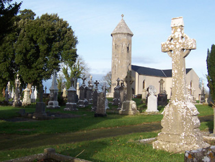 Saint Mary's Catholic ChurchChurch/chapel · 783 yd
Explorer Tom Saint Mary's Catholic Church in Corkan gave up its bells for Lent, which was a bold move given how quiet it gets…
 Earthwork in Skeagh MoreEarthwork · 826 yd
Explorer Tom Earthwork in Skeagh More is secretly proud of being the only thing visible on an old map from 1808. It sits at the base…
 Milltown GAAGAA ground · 991 yd
 Rathcastle HouseDemesne walls/gates/railings · 1442 yd
Explorer Tom Rathcastle House has an elegantly appointed gateway that would tell a teenager the 1800s were just long pants and bad…
 CastleCastle, unclassified · 1.3 mi
Explorer Tom Castle in Rowlandstown would bring a plate of cold chips and a strong opinion about politics to any party it attended.…
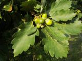 Sessile Oak4.0 mi
Explorer Tom Sessile Oak in County Westmeath is standing there looking distinctly smug, probably judging your life choices from its…
 Abbeyshrule CemeteryCemetery · 4.9 mi
Explorer Tom They say it took over forty cups of tea just to design Abbeyshrule Cemetery’s layout, which explains why the paths are…
 Abbeyshrule Castle (in Ruins)Castle, tower house · 4.9 mi
Explorer Tom Abbeyshrule Castle makes a weird creaking sound at night, probably just the ivy stretching. It sits right next to a…
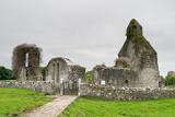 Abbeyshrule AbbeyRuins · 4.9 mi
Explorer Tom Abbeyshrule Abbey in Longford was nearly sold off as a very expensive horse stable back in the day, thank god. The…
More archaeology and monuments in County Westmeath · All of County Westmeath

What do you know about this place?Tap to add a comment or ask a question